Prepare for Offshore Sailing and Emergencies at Sea!
Building a Custom Aluminum Sailboat Part 1 - From Plans to Plates to Assembly
Offshore Passage to Grenada
Trimaran Test Sail
Southbound to the Bahamas
Check out the episode below…
Sailing North with the Gulf Stream
This is our last sail on the amazing Bahamas shallow banks as we're preparing for the passage north to Beaufort and the Chesapeake Bay. For the first time we're going to sail right up the Gulf Stream and hope to use the current to add to our speed.
We are using the Predictwind software to get our weather and gulf stream forecasts via IridiumGO so we can receive updates even offshore. This is a first for us and worked very well. Although the updates can be pretty large even up to 1 MB or so it can be received over our connection if you choose a smaller forecast area for regular updates.
We catch a large Mahi-Mahi, bake bread, and set up the sails for fast downwind passaging with the current pushing us up to 11 knots.
When we pull in to Beaufort North Carolina we demonstrate using the current and wind to help get out of the dock in a tight situation.
Sailing Across an Ocean on a Catamaran - Bluewater 50 by Discovery
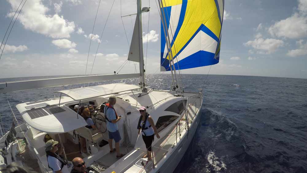
We had very light winds for this passage and ended up flying the spinnaker for many days. Winds were from astern as expected on this route but often under 10 knots true - which is lighter than the typical 15-18 we have experienced on this crossing before.
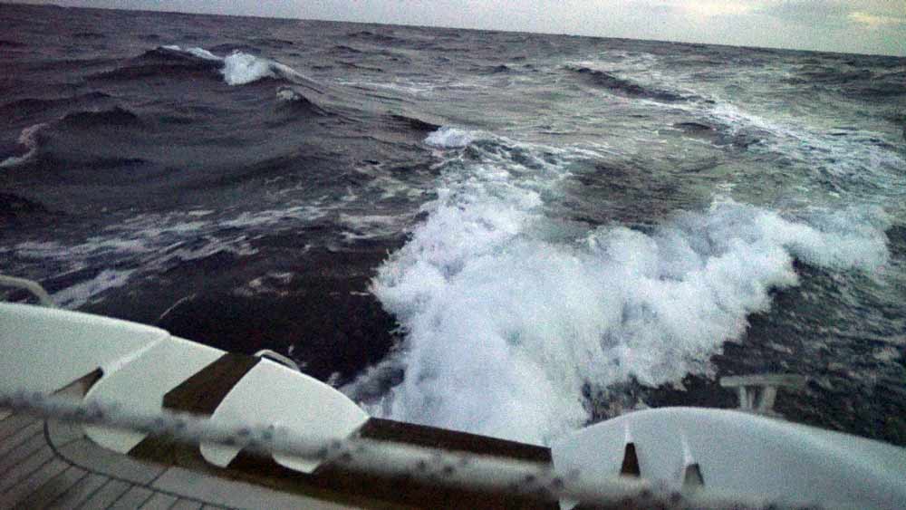
The first 2 days out from Las Palmas we had the more typical winds at 15-18 and she roared along at 10 knots showing how powerful and easy it could be. The winds were to be much lighter for the rest of the cruise!
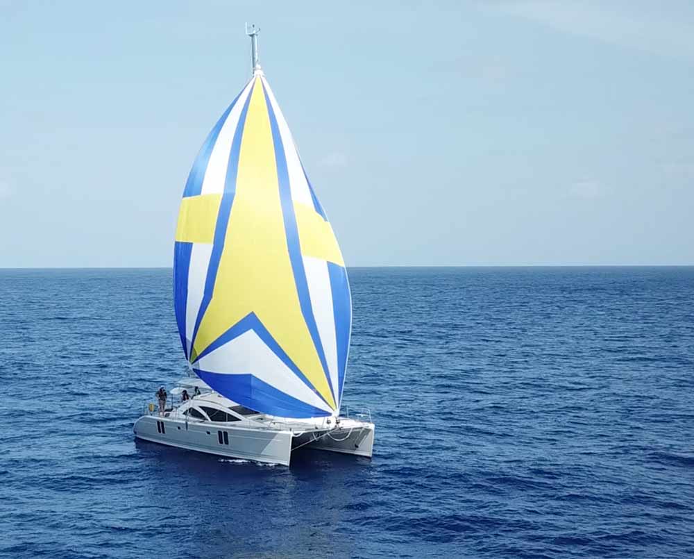
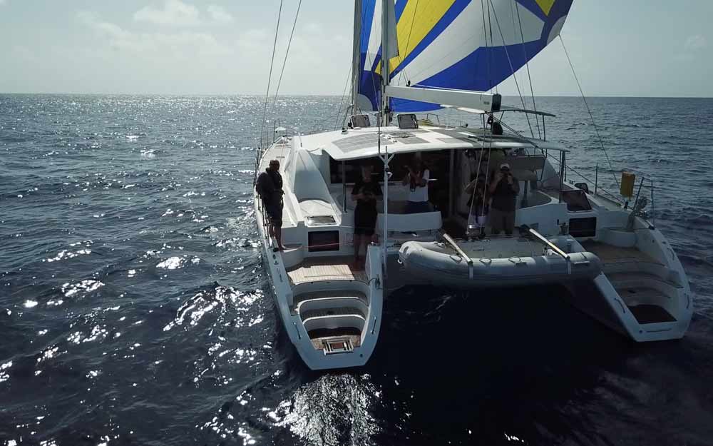
I had planned that most of the passage would be done with our twin headsails. This is my favourite rig for our monohulls where we fly one jib on a pole and the other using a block on the end of the boom. On the wider catamaran we barber-hauled the jibs out to the beam and moved along well dead downwind. This rig was also perfect for night sailing as it doesn't need the management of a spinnaker, and can be easily reefed if a squall comes by. (Photo Courtesy of Craig from CruisingOffDuty who bravely flew his drone to get get the aerial shots)
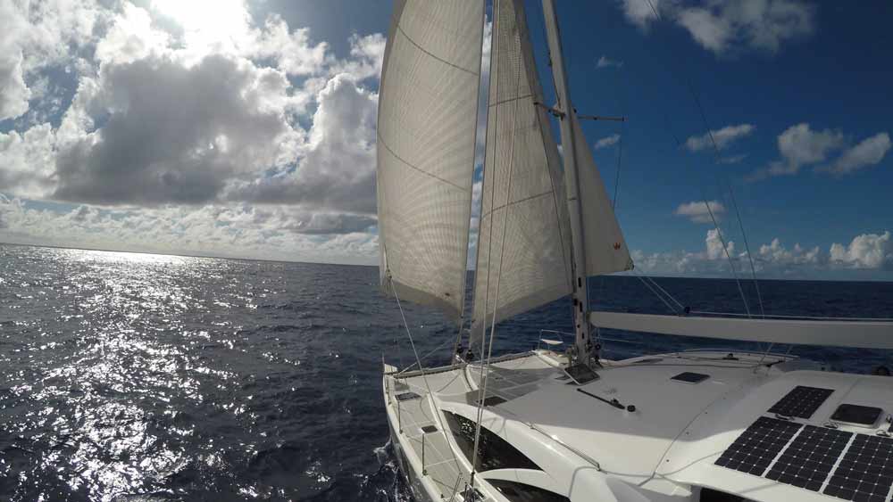
This is actually an asymmetric spinnaker but we flew it two different ways.
1) as a symmetric spinnaker we ran both sheets to blocks on the two bows
2) as an asymmetric spinnaker we ran one sheet to the bowsprit, and the other sheet aft to a block by the stern
In this picture we're flying the spinnaker off the two bows.
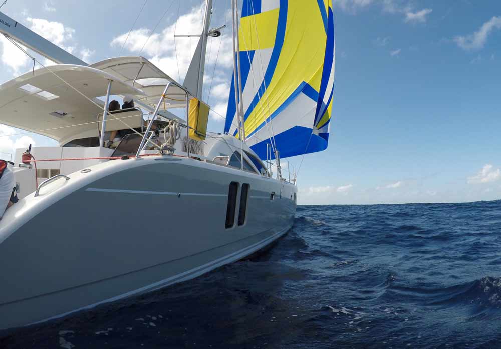
From the masthead you can see how the spinnaker is running to both bows. This was our most common rig and worked well dead downwind.
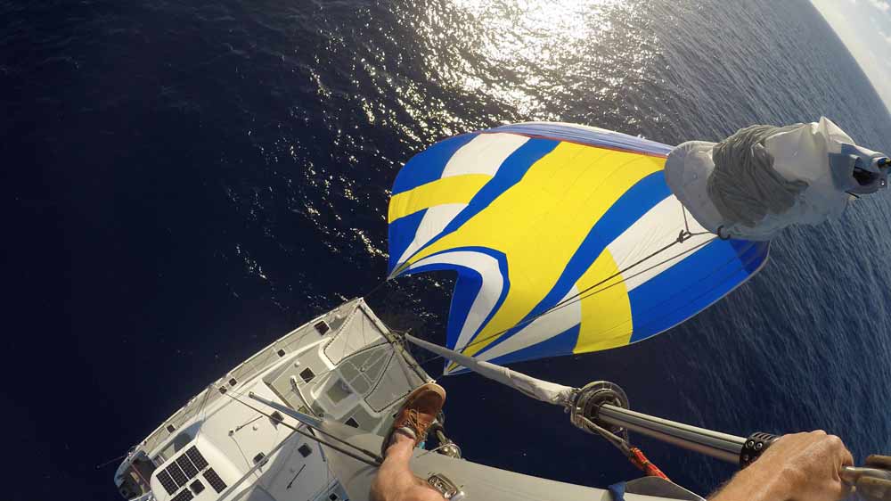
Flying the spinnaker from the bowsprit here you can see the sheet running aft on the starboard side.
One day the wind dropped below 5 knots so we went for a swim. Sheryl stayed on board and I went down below to see how we looked from underwater. Its 3 miles deep right here and the visibility is about 200 feet!
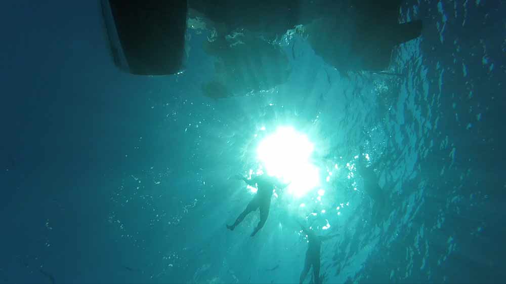
We shot a TON of video on this crossing! I'm currently working on the footage and will get something up on YouTube shortly.
Crossing an Ocean
I'll always remember the sense of accomplishment Sheryl and I felt as we came in to Horta in the Azores after crossing our first ocean. Wow! We were tired and ready for a real night's sleep. It had been an 18-day double-handed crossing with sleep in 3-4 hour stretches and included our biggest storm to date. Boy were we thrilled to have sailed across the Atlantic!
 That was way back in 1990 in our first year of cruising/living aboard. We've since spent hundreds of days at sea out of sight of land including 6 more Atlantic crossings but the thrill of that first one is still a life memory.
 The Proper Yacht - Room for Crew
On that first ocean crossing we were aboard Two-step, a Sparkman & Stephens design, we built ourselves from a bare hull and deck. This 37-footer was a small boat inside and a wet boat with low freeboard, but we sailed her 68,000 miles and three times across the Atlantic before moving up to our next boat. (The second picture is our third boat, Distant Shores II, a Southerly 49, sailing downwind wing-and-wing. Much nicer!)
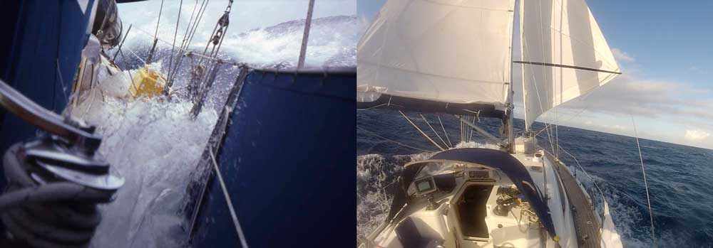 But perhaps one of Two-Step's biggest shortcomings was that she was a bit too small for bringing along additional crew. Doing watches 3 to 4 hours-on-/3 to 4 hours-off gets tiring. Nowadays we prefer doing passages with additional crew. Even one more crew means you can reduce the watch schedule, 4 people total and it makes a much more pleasant passage where everyone gets much better sleep.
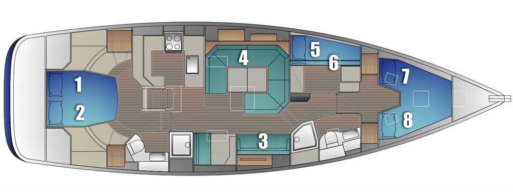
 Our new boat, Distant Shores III, a Southerly 480, is being built from the ground up with the plan to accommodate extra crew on passages. Distant Shores II could only handle 4 people on offshore passages in comfort. Distant Shores 3 is designed to have 6 aboard (Sheryl & I plus 4 additional crew) and we are planning safe comfortable sea berths for all. Here is an interior plan… For Offshore we will have a maximum of 6 people total aboard including us, and crew can choose the best berths for the conditions and preferences.
What's it Like at Sea?
It's not all storms and excitement on the ocean, although we certainly expect some exciting squalls on this passage. The transatlantic trade wind crossing to the Caribbean from Europe is likely to be all downwind. We have had a few calm days on 3 of our 4 east-to-west crossings on this route, but mainly the trades blow 15-20 knots or more from the east. We set the sails and roll along downwind, sometimes not even adjusting the sails for days on end. Typically there are squalls that pass regularly bringing rain and winds gusting up to 30 or so.
Here is a video from our recent Atlantic crossing in 2015 as we are completing our crossing the Atlantic to St Lucia. Everyone is very excited!
Offshore Ocean Overnight
If you've never done an overnight passage on a sailboat the thought of crossing an ocean and spending perhaps 18 days out of sight of land might well be daunting. In that case we would recommend a shorter passage first - one or two nights just to see if you like it.
View Schedule - Legs - Availability - Click Here
Do You Want to Cross an Ocean?
This isn't a dream for everyone! It's a big adventure and requires a big commitment in time. But if you dream of crossing an ocean then the trade-winds crossing of the Atlantic from the Canary Islands to the Caribbean is certainly one of those dream passages. Setting off in cooler fall weather from the Canary Islands, we head south for a few days. Tradition says "sail south until the butter melts" but with modern weather routing software we can make a better plan than that! On our last crossing we stopped at the Cabo Verde Islands, and we plan to do this again on our next crossing too. The islands are dramatic and friendly and it's a nice way to get 850 miles under your belt, then take a few days rest before jumping off for the big transatlantic crossing.
Join us Aboard Distant Shores III
We have always enjoyed bringing people along with us through our television shows to share the ocean life. Now with Distant Shores III we have planned the boat so we can bring along 4 additional crew and share the lifestyle directly. We have planned some passages in our Sail Away Weeks schedule. The big one is crossing the Atlantic (via the Cabo Verde Islands). We have planned 25 days this for adventure with probably 16-18 days at sea. That gives us a week or so in the Canary Islands, Cabo Verde Islands and Antigua when we arrive to celebrate!
For a smaller sampler of offshore sailing we are doing a passage from Gibraltar to the Canary Islands. We plan a stop in Morocco either at Rabat or Agadir. Either stop means there will be a leg of a few hundred miles (2-3 days) at sea on passage before we arrive in the Canary Islands at Lanzarote.
View Schedule - Legs - Availability - Click Here
If you'd like to join us for a "virtual" ocean crossing then why to check out our recent videos on the Atlantic crossing…
Join us aboard Distant Shores for the adventure of a lifetime crossing the Atlantic
Ultimate Passagemaking Sailboat - Accommodations
By Paul Shard, Copyright 2016. All rights reserved.
Are you planning an extended cruise? Is "bluewater cruising" in your future? If so you may be planning to bring additional crew along on some of the offshore passages. Read on!
Planning our ideal passage-maker I have been looking at other layouts in the 45-50 foot range. Here are a few of the best known names in offshore monohulls. Hallberg-Rassy, Oyster, Hylas, and comparing to our last boat, the Southerly 49. We're looking at planning a passage with the two of us aboard, and planning to have extra crew join us on some longer passages. Let's see how the boat would accommodate the extra 1-3 people on passage, as well as how the boat could be set up for extra guests on routine sailing and exploring.
In these images below I have labelled the preferred berths as I would assign them to my passaging crew. We need to look after our crew!
Oyster 475

Above is the Oyster 475 with a lovely large aft owner's cabin. The galley is nicely located near the centre of the boat for reduced motion. On passages I would plan to use the aft cabin with lee-cloths to keep off-watch crew secure. There are 2 more sea berths just forward of the mast, and if a fifth person was aboard they could use the saloon settee. If going downwind of course you could use the forward cabin, but on many passages that berth will have too much motion for this watch keeper :-) So the Oyster layout will give you an extremely comfortable boat for the typical cruising couple, plus accommodate 3 additional crew for passages all in their own bunks.
Hallberg-Rassy 48 MkII

Here is an interesting take on an interior designed to look after 2 couples in style. The forward cabin is called a "Super Cabin" by Hallberg-Rassy who correctly suggest most cruising boats are sailed by 1 or 2 couples. Instead of a lot of small cabins common to ex-charter boats, they propose 2 very nice cabins and a smaller 3rd cabin forward. Seems like a good idea. For passage making there are great bunks for 4 people, but the 5th would need to climb over the 4th in my picture above. Both the 2 luxurious cabins have separate showers - nice!
Hylas 49

The classic Hylas layout again has 2 people in the luxurious aft owner's cabin (separated by a lee cloth). The 3rd crew have a private cabin just forward of the mast, then 4th and 5th crew get to curl up a bit on the saloon settees. This is another nice layout for a couple, and there is a luxurious forward cabin for guests up forward, although they would likely not want to sleep there on passages unless downwind. Neither heads appear to include a separate shower. The large galley is nicely positioned near the companionway and narrow enough to keep the cook in place and comfy on passages.
Southerly 49 Distant Shores II

Distant Shores II - our Southerly 49 has the main owners cabin forward so we always moved out of it on passage and slept in the aft cabins. A third crew slept in the saloon, and finally the 4th could sleep forward, or divide one of the aft bunks. These cabins are a bit low to make access for the second berth bit difficult, so in practice we only did this a few times. Downwind I (Paul) used the forward cabin on our last downwind transatlantic passage. The galley is nice at sea… although there is a bit more motion than if the galley was aft. The forward shower is a dedicated unit.
Aft Cockpit or Centre Cockpit
I think many people will agree the main aft owner's cabin is a good feature. Aft cabins are great as they allow spacious headroom above the aft cabin, but this centre cockpit design means a smaller cockpit. We enjoyed the large forward stateroom on DS2 but did not like that we had to move aft for passages. Our 49 had that nice large cockpit, but paid the price with lower headroom in the 2 aft cabins.
What do you think?
Would you prefer an aft cabin, or aft cockpit? Or something else?
PredictWind Weather Forecasting & Routing Review
How can you get weather updates while at sea? What is the best day to set sail on a passage to get the best conditions en route? How do you choose the route for the fastest and most comfortable passage?
Getting good weather information at sea used to be one of our biggest challenges over our 26 years of cruising internationally. That has changed dramatically this past year as we have been testing PredictWind.
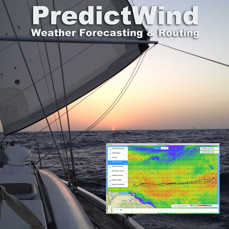
PredictWind is a subscription weather routing service that integrates with the IridiumGO satellite communication network. As we were doing over 6,000 sea miles and 2 transatlantic crossings this year it seemed a good time to try it out.
Although PredictWind can be accessed through a website, what caught our attention was their IridiumGO interface and app. This means we can access weather forecasts and routing information while we're at sea using the IridiumGO unit.
We run the PredictWind app on our Mac laptop connected to the IridiumGO by wifi and ask to download a forecast. It takes a couple of minutes to connect and presto - we have downloaded a GRIB with the weather and routing data. The app has a very good GRIB reader so you can immediately check out the PredictWind forecasts.
Multiple Forecasts
A feature for the true weather aficionados - PredictWind uses four different weather models. GFS CMC and two special PredictWind algorithms. I have been using them to compare and average the forecast models. Having the side-by-side display of the different weather models definitely helps raise your confidence in the forecast, or make you aware if the different models are disagreeing. A very good feature!!
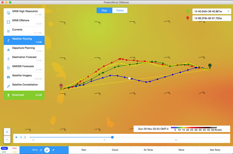
(note in the lower left the key for the 4 models with the PWG forecast route highlighted in blue)
Weather Routing
Getting weather and GRIB files at sea is great but then you need to work out the best route for a fast and comfortable passage. For most of our 26 years of cruising I have done the job myself, "guesstimating" our performance and stepping off our daily run on the paper chart (remember those 😀)
Nowadays sailors have a couple of options: 1) Retain the services of a professional weather router who can email, phone or radio you with daily reports and suggestions or 2) use PredictWind to do the routing with their powerful computer and send you reports on demand. We've been testing PW routing this season and it's been excellent.
To calculate a route you need to know how fast the boat will go given different wind strengths and headings. PredictWind lets you put in a custom polar table for your boat, or choose from a number of tables they have already set up. Then when you want a route suggestion you just click on your start and destination and input your planned start time. The PredictWind central computer sends back a detailed report with suggested routes for each of the weather models and tables showing the conditions to be expected along the way. The file they send back is very small - just a few KB - so it's easy to receive at sea over satellite or SSB pactor.
Here's a sample of our passage routing file from the leg across the Atlantic. Depending on which weather model is used, we might expect to take 12-13 days. Of course weather forecasts 2 weeks out are not going to be that great, but we are updating it at sea whenever we want! Nice.
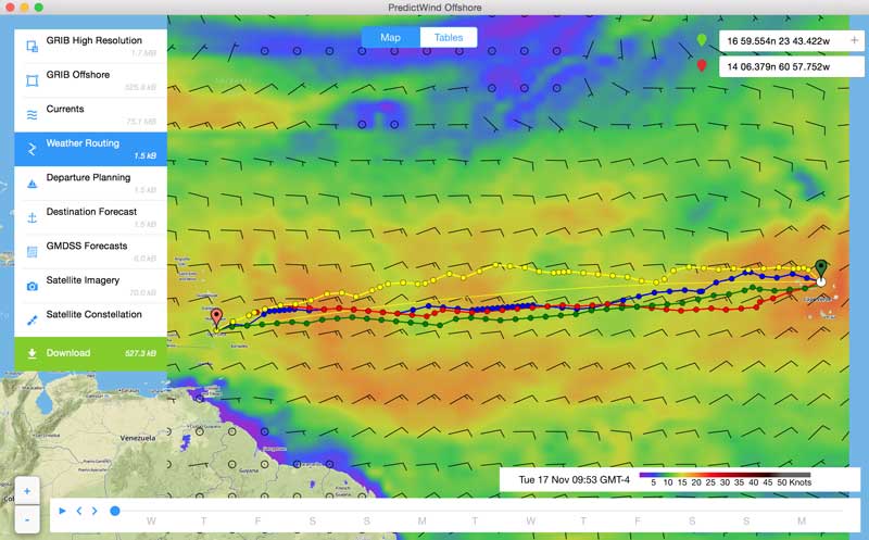
Departure Planning
Looking for that "weather window" for a tricky passage? When should you set sail to get the fastest or most comfortable passage?Running through the scenarios for the best departure date used to take me awhile and was a bit of a rough estimate, as I would quickly step off estimates of our daily runs given the weather forecast. PredictWind has a great feature that does this for you! "Departure Planning" allows you to quickly compare a set of departure times and see what the passages would be like. In the example below we are comparing 4 departure dates a day apart - leaving December 8 at 12:15 and 24,48 and 72 hours after…
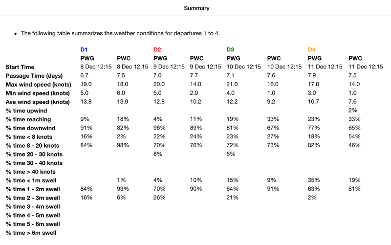
Note how it summarizes how much time will be spent upwind, downwind and the percentage of time in which wind strengths and swell heights….
Extra Features
In this review I haven't been able to cover all that PredictWind can do but before we finish, here's one nice extra for the cruising sailor who has a website (like us :-)This is a nifty tracker page that PredictWind has coded. You can put it up on your website and the folks at home can see where you are. This uses an IridiumGO feature to track you, and PredictWind updates the positions on this map… and makes the folks at home feel better…
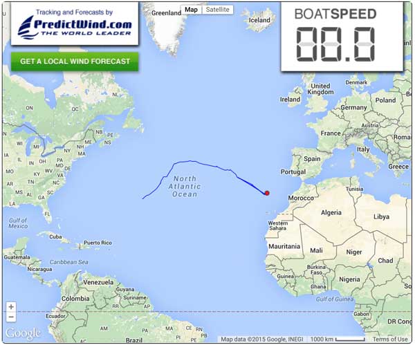
The Verdict
PredictWind is an excellent solution to the cruising sailor's basic need - reliable knowledge of the weather at sea. Plus it does a remarkable job of providing weather routing. Paired up with the IridumGO unit it is an amazing combination for the offshore sailor.Read More
Check out the PredictWind website for more information here…
How do you get your weather information when at sea? Have you ever tried PredictWind or used other weather routing systems? How did they work out for you? We value your opinions. Please leave your comments and/or questions below…
And please share with a friend you know who might enjoy learning about this weather routing system. Thanks!
You may also like:
IridiumGO! - Review for Cruising Sailors
Transatlantic Passage Planning
When to Abandon Ship
The O Words - Offshore, Ocean, Overnight
Distant Shores III - Criteria for the "Around the World" Sailboat
Sheryl and I have now sailed over 100,000 miles on 3 different boats over 26 years of cruising. We plan many more ocean miles and "sailing around the world". If you've followed our exploits you know we like poking into cute places, and crossing oceans as well. The next boat will do all of this, even better than before!
Sailing Qualities - Upwind ability
All 3 of our boats have been quite good upwind. Our Classic 37 Two-Step was pretty good at pointing but was also a wet boat to windward and pitched too much with her short 27 foot waterline and long overhangs. Those are wet decks!
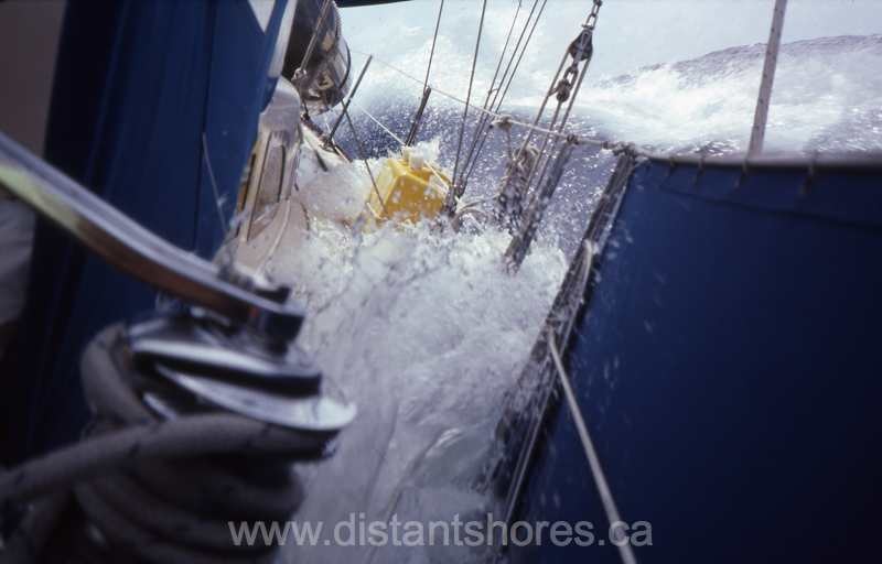
The Southerly 42 was better and much drier. But our Southerly 49 Distant Shores II is the best. She draws 10'2 with the aerofoil keel down and she heads very close to the wind. The new boat must be as good as this…
Comfortable Motion
All three of our boats have been on the heavy side, and this means softer motion at sea. But the 2 Southerlies have had long waterlines for their length. This translates to a good motion with good speed as well.
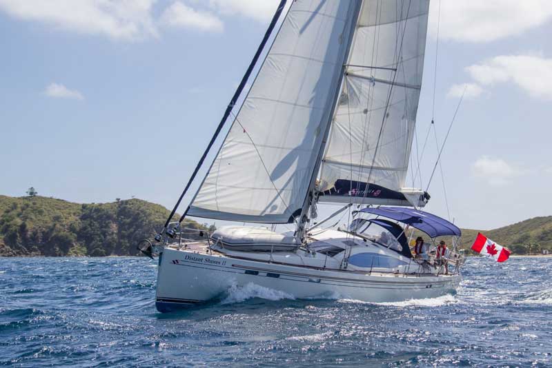
180 Miles a Day
On the last transatlantic passage we averaged nearly 200 miles a day. After 26 years of sailing we have come to believe a faster boat offers the ability to avoid bad weather, make passages in shorter weather windows or divert away from bad weather. 200 is difficult to achieve but 180 mile regular runs are possible.
Light wind ability
More common than storms, light air conditions are often overlooked when buying a boat. We quite enjoy light air passages (such as our very light transatlantic passage last spring). Our Southerly 49 is pretty good in light air but we do not have a bowsprit to accommodate a code-0 sail. That will be on the list, as well as tankage for 800-1000 miles of motoring.
Downwind Ability
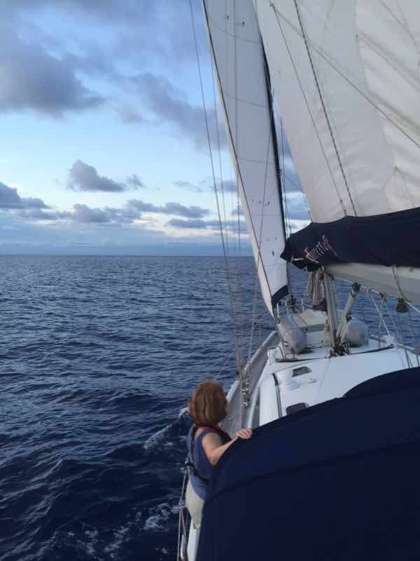
With her swinging keel we can go very well downwind with the Southerly 49 (we swing the keel most of the way up).
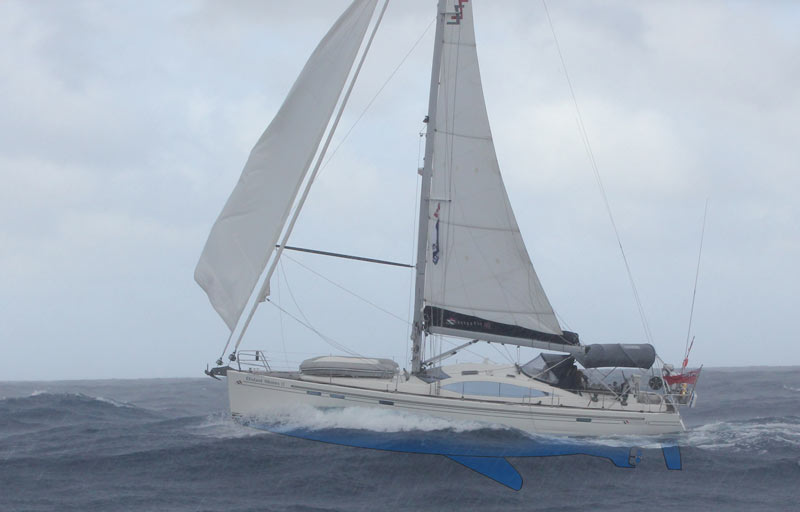
Our only real complaint with Distant Shores II for downwind work is that her spreaders are too far swept-back. This means you can't put the boom all the way forward as we could on Two-Step. Jibing is difficult to prevent if the boom isn't all the way out (as when we jibed and broke the traveller car mid-atlantic). DS3 will have less swept spreaders.
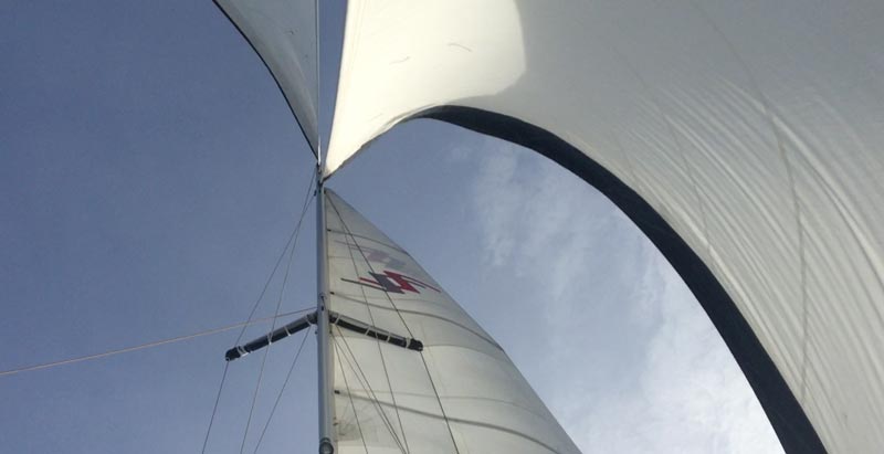
Tough Construction
"Around the World Project boat" will be extremely tough. You never know but we might end up rounding Cape Horn or transiting the Northwest Passage (last one less likely). I will ruggedize the bow with additional kevlar to toughen the boat. Our friends John & Amanda on Mahina Tiare III recommend that a boat should be able to withstand a 6 knot grounding. Good advice. Many modern hulls will not survive this. DS3 will for sure!
Cockpit and Helm Position
Both our Southerlies have had traditional fabric dodgers - which we almost never fold down. We had this on our Classic 37 Two-Step but replaced it with a custom hard-dodger project. The new boat will have a hard dodger. Although centre cockpit boats have many advantages, moving the cockpit forward tends to mean its wetter with more spray. The aft cockpit is easier to sail, and with a hard dodger there's also a comfy place for rougher weather.
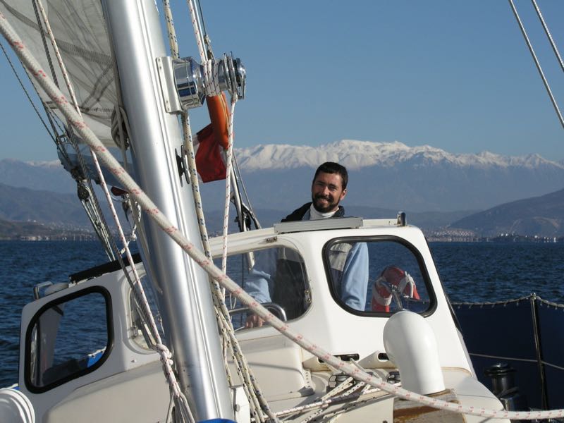
Accommodation - Passagemaking
Our most pleasant long passages have been with competent friends along as crew. For passages we need comfortable and safe sea-berths for 4 people. We have done 4 ocean crossings and numerous 1,000 mile passages with just the 2 of us, but having crew comfortably aboard is a great option.
Accommodation - Coastal Cruising
We like having guests aboard. At a minimum, a really nice extra cabin for a visiting couple is a must.
Galley
Our ideal is a U-shaped galley near the companionway with plenty of storage and good ventilation.
Shallow Draft
We just really love exploring, and have found the shallow draft works for us. DS3 will be shallow draft for sure - able to poke in rivers, the gorgeous Bahamas, canals, inland waterways etc. We have now sailed 40,000 miles in our swing-keel Southerlies. Done properly this has very few drawbacks - mainly added complexity and some expense. Swing-keels offer benefits of access to cruising grounds out-of-bounds to others, plus the ability to have a VERY deep draft with the keel down.
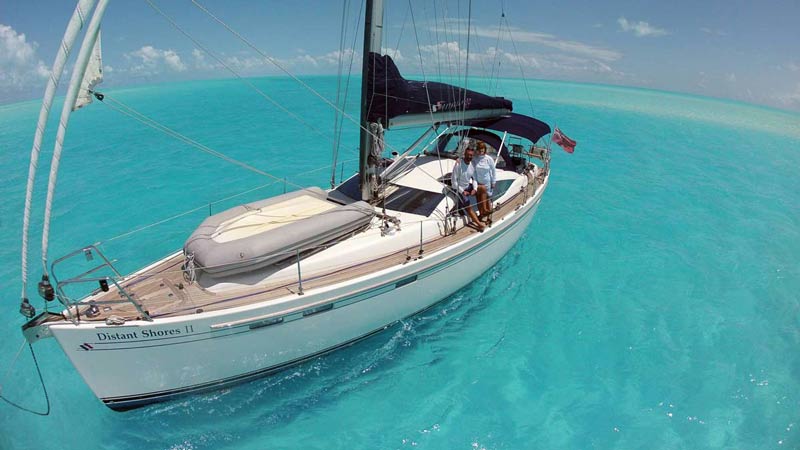
In the next few weeks I will be putting up posts with much more detail on the new Distant Shores III, design, systems etc.
I welcome your comments and questions … and if you're considering a shallow-draft world-cruising boat in the future I hope following our boat-building project will be helpful to you.
Top Ten Transatlantic Sailing Gear Review
Crossing the Atlantic ocean is a real test of both crew and gear. This year we have done two Atlantic crossings and tested the gear quite a lot!! Here is a round-up of the gear aboard Distant Shores II that contributed the most to our passages… comfort, safety, performance etc…
1 - Downwind pole
Our Selden downwind pole was great. It's made of carbon fibre so its light and easy to set. We used it for almost the whole passage. Having a strategy for going dead downwind is essential for a successful trade wind passage. (Blog Here)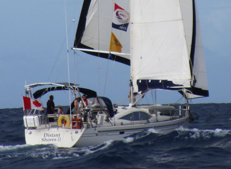
2 - Raymarine Plotter with Lighthouse software
I've written before about the ability to upgrade the Raymarine Plotters. In this upgrade the AIS display is much improved with icons showing the type of vessel (note the ship's boxy icon below). Nice! This is our custom display set up for the helmsman. Course-up plotter with radar overlay on the left, and nice big wind display on the right showing both true and apparent wind.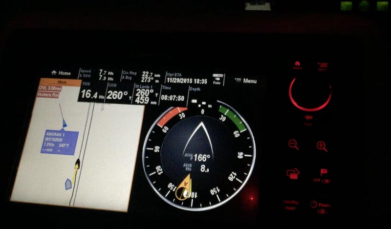
3 - Autopilot steering with "relative wind" heading
We hand steered for less than 1 day total of the 11 days on this crossing. "Auto" steered perfectly for the rest. We used the Raymarine "Wind" relative setting and it was excellent. When steering nearly dead downwind, even a wind shift of 20 degrees could mean you might jibe. The relative wind setting on the autopilot means the system will keep adjusting the heading so that isn't a danger. It worked very well! Note we are sailing nearly dead downwind!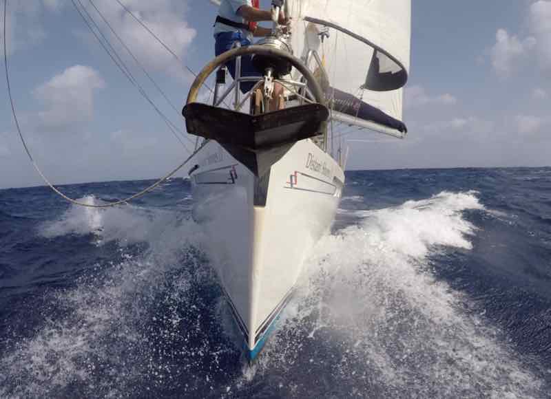
4 - Solar Panels
Our new solar arch provided a lot of the power for the crossing. We still ran the generator 1-3 hours per day, but we were not trying to conserve power either. We ran radar whenever we wanted to check on squalls, everyone ran their devices etc. The solar power was also a reassuring backup in case we had a problem with our generator.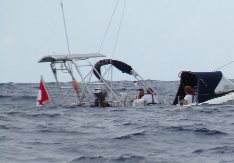
5 - Pressure Cooker
Sheryl cooked up some quite amazing meals and made a fair bit of use of the pressure cooker. Quick and easy. Our model is a very tough stainless unit we bought in France while travelling the canals. Great for one-pot meals! With its locking lid it's safe to use in rough conditions. It reduces cooking time and reduces heat in the boat.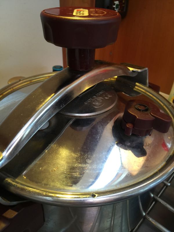
6 - Headlight
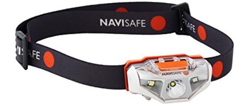
Actually my headlight is terrible - but our crew Anthony had this Navisafe headlamp and it was by far the best I've seen - powerful, waterproof with both a spot and wide beam.
7 - IridiumGO
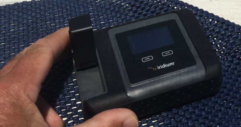
Communications were the best we have ever had for a passage. Email, weather, texts, phone calls, weather routing etc… Predictwind review to follow! Check out our IridiumGO review here.
8 - Life-raft
Thankfully not used but it is the peace-of-mind knowing you have the best safety gear, especially when going so far offshore. Check them out on Ocean Safety.com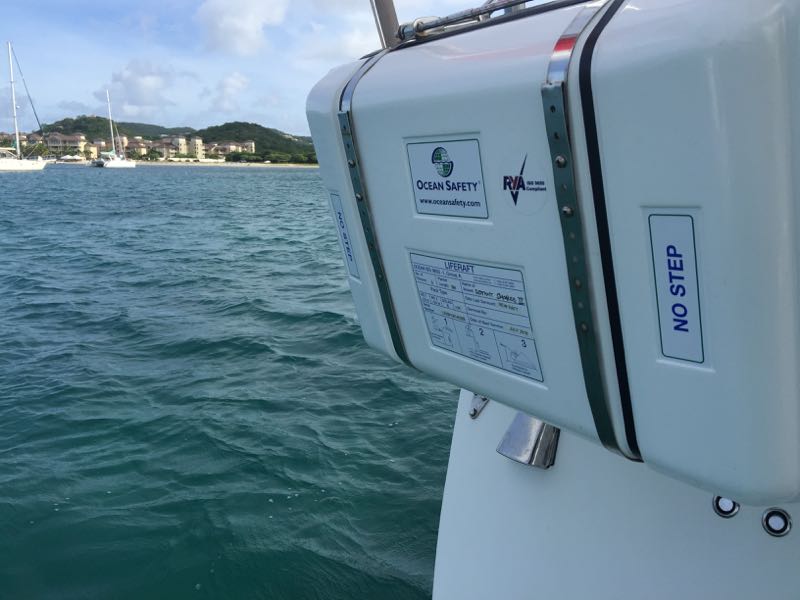
9 - Lifeproof case for my iPhone
While everyone else worried about their phones on the crossing, I didn't since my new case is waterproof! Works great!! Waterproof to 6 feet/2 meters but we didn't test this :-) Here it is on Amazon
10 - Cabin fans
Our Caframo fans have been great - especially on a passage when we don't want to open hatches. Its hot sailing the trade wind route and the fans helped us keep cool…Storm Spinnaker - downwind rig with twin headsails + mainsail
Sailing east to west across the Atlantic means following winds almost all the way. On this passage we have just spent the entire 11 days nearly dead downwind. Only when the occasional squall went by did the wind shift even as far as 30 degrees, so to steer our rhumb line course we would have the wind from 150 degrees to 180 degrees dead downwind for the whole way. If you are planning this passage you definitely need to have a good strategy for sailing downwind. Of the 60 boats sailing across the Atlantic with us in the ARC-Plus this year, there were a few who didn't have a good downwind strategy, and all regretted it! It's frustrating to have to sail off at a broad reach, adding so many miles and days to the crossing.
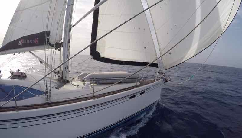
We ran for over 95 percent of the crossing with what we call our "storm spinnaker" and it was very effective! We were near the front of the pack - 9th of 60 boats to finish, and the first monohull under 50 feet. We exceeded our predicted 12-13 days time, finishing in 11 days 7 hours! Whoa!!
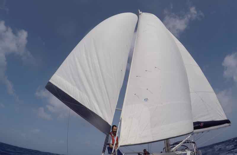
Storm Spinnaker
What's a storm spinnaker? We do not carry an actual spinnaker, but use our two jibs to make our best imitation of a spinnaker shape, poling the genoa out on the windward side and using the smaller jib on the other side in behind the mainsail. Looking at it from the bow you can see the two headsails form a shape nearly the same as a single curved sail.
Twin Headsails
I really like our Solent rig with two headsails on furlers ready to go. But if you don't have that, there are still some possible alternatives to fly twin headsails this way. A "Solent stay" can be added just inboard of the main forestay, and you can hank on a smaller jib. We added this rig to Two-Step many years ago, and it was how we fell in love with the twin headsails. Here is a great article in Sail Magazine that details how best to add a Solent Stay.

Collapsing Sails?
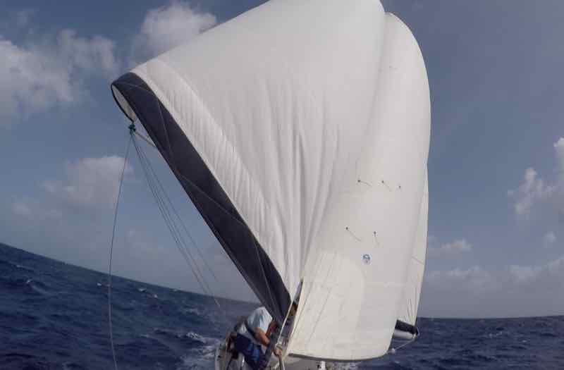
Sailing nearly downwind we wondered if the smaller jib would be blanketed by the main, and might collapse? After all we were heading 165-175 degrees off the true wind. In the event, we found that by trimming the sails we were able to get maximum speed, comfort and reduced rolling, and the sails didn't collapse. For example, we set our Raymarine Autopilot to steer a relative heading to the wind of 165 degrees. We set the pole and genoa well forward catching as much wind as we could. But between the main (to port) and the genoa (on starboard) there is still as gap. So we set the second jib to catch that wind, making the two jibs look somewhat like a spinnaker. We found it worked best if the smaller jib was sheeted in a quite a bit tighter. It will both help catch the wind, and stop the rolling motion in the big Atlantic swells. In the picture below you can see the jib (on the right of the photo) is sheeted well in.
What about a real Spinnaker?
Certainly this can come in handy - but almost all will take down the spinnaker at night, and overall I would estimate they were flown by most boats for just 1-2 days. We had our rig up for the entire time! Spinnakers are a great option, but first of all I would recommend a good setup for poling out the genoa and running the main in a wing-and wing configuration.
Reefable
Our two jibs are on independent Furled furlers, which means we can reef in a little or a lot very easily. We left the furling line for the larger genoa on the winch, and even at night one of us on watch could reef down in seconds if a squall came up. When gusts came up to 30 knots we found we were fine with just a 20-30 percent reduction to the genoa. Any higher and we would reef up the jib a bit. We also were heading downwind so a true wind of 30 was barely 21 or so relative to our downwind course.
Lock the Downwind Pole in Place
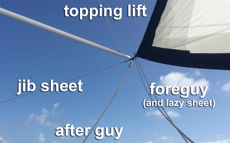
Whenever we use the downwind pole we make sure its locked in place. We rig up 3 lines to the outer pole end…
1) Topping lift - pole height is adjusted by a topping lift to the outer pole end
2) Foreguy - this line is permanently rigged on the foredeck and runs back to the cockpit. When we need it we run it to the pole end to hold it forward.
3) Afterguy - we run the third line from the pole aft to a midships cleat
With these three line the pole end is completely controllable and held in place. If we need to reef the jib away we can just reef the sail in leaving the pole out in position. No worries!
Main Boom Preventer
Running downwind we have the main boom all the way out … and ran a preventer to stop accidental jibes. This means we ran a line from the very end of the boom forward to the bow so the boom couldn't swing across if the wind got behind the sail. In fact it is quite easy for a big wave to push the transom and you find the boat swerving around suddenly heading off 30 degrees… a jibe is all to easy.
We actually had some difficulty with this and the first time we jibed the preventer didn't hold it!! We had a crash jib and broke the mainsheet and traveller cars. What went wrong?
Back when we sailed Two-Step, our Classic 37 cutter, the mast didn't have swept back spreaders. This meant you could put the boom out further, nearly at right angles to the hull, and the angle on the preventer was very effective. Now with many boats like ours having swept-back spreaders you can't get the boom as far forward. See below how the boom on Distant Shores II is not all the way out, and therefore the angle to the bow will mean the preventer must be tight and strong to hold the boom against a jibe.
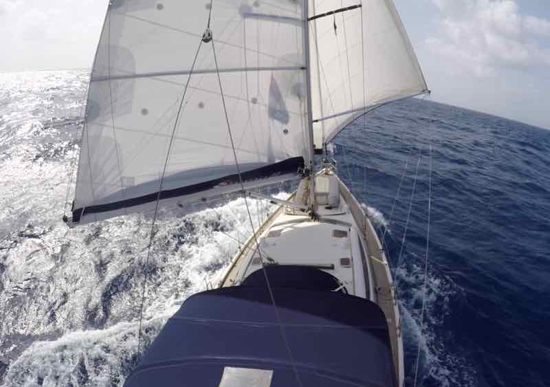
Our original setup for the preventer was just not tight enough, and had too much stretch in the system. You see it on the right of the photo below running forward and coming over the lifelines, another reason it couldn't be tight enough when rigged this way.
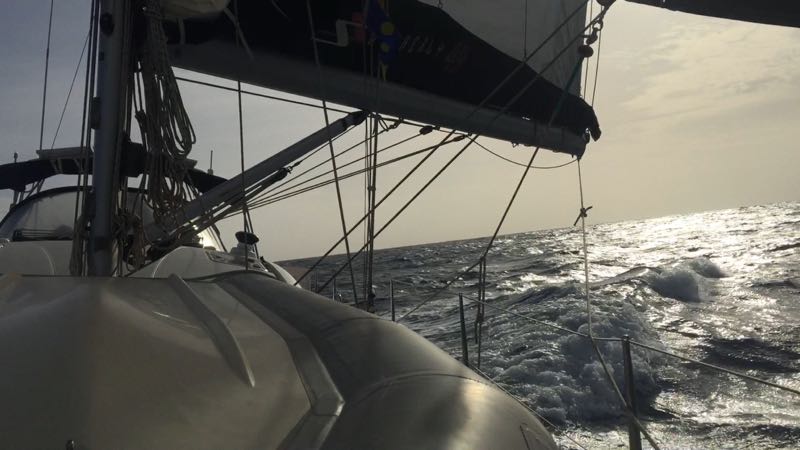
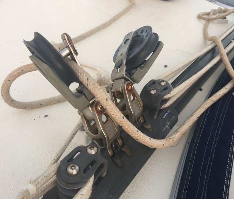
When the wind got behind the main, the preventer held a little, then stretched and the boom swung across anyway. Crash Jibe! Results below as we broke the mainsheet and the two blocks on the traveller.
An Improved Preventer
We carry spare blocks and plenty of rope so in just 15 minutes we were up and sailing again. But we wanted to improve the preventer to guarantee no more jibes. The solution was to use a heavier non-stretch sheet for the preventer, and to bring it back to a cockpit winch so it could be tensioned up.
If your rig is like ours with swept-back spreaders, you might be able to do as we did. Run the preventer forward to the bow around the bow cleat then back to the cockpit on a winch.
Enjoy Downwind Sailing
Whichever rig you choose, gennaker, spinnaker, twin jibs, or something like ours with main and twin jibs, do not overlook the need for a good versatile downwind rig. Especially for the classic trade wind passages you need to be able to do something to catch those lovely warm breezes and enjoy sailing downwind.
ARC + Life
Getting ready!!! We will be setting sail on Sunday for the first 800 mile leg across the Atlantic to the Cape Verde Islands, and whenever a big passage is coming up we naturally have a lot of preparation. There seems to be an ever growing list of things to accomplish. This is especially the case since we entered in the ARC+ rally, so the departure date is not flexible as when we set off on our own. So here's a day in the "Life" of ARC+ aboard Distant Shores II.
Lifelines
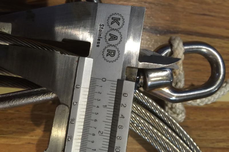
Today we are replacing our lifelines! On the passage from Madeira we noticed one of the lower lines were nearly broken where it went through the stanchion. Goes to show - you need to look quite carefully at the hidden parts - in this case probably weakened when we hung a fender on that point on a very "swelly" day in Madeira's Funchal marina.
We are replacing all the lifelines and also changing them. The picture shows our 4mm lower which we will replace with the same spec. But the uppers will be replaced with 5mm wire for more strength (they were also 4mm)
Liferaft
Our new liferaft is arriving today, so we will have to fit it to the bracket on the stern rail. It might fit easily (haha that never seems to happen :-) but you never know. It is an Ocean Safety "Ocean ISO9650" six person liferaft.
Lifesaving
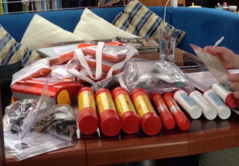
Checking over our flares and emergency equipment… good idea to reread the instructions for the flares as they are often not at all intuitive.
Lifejackets
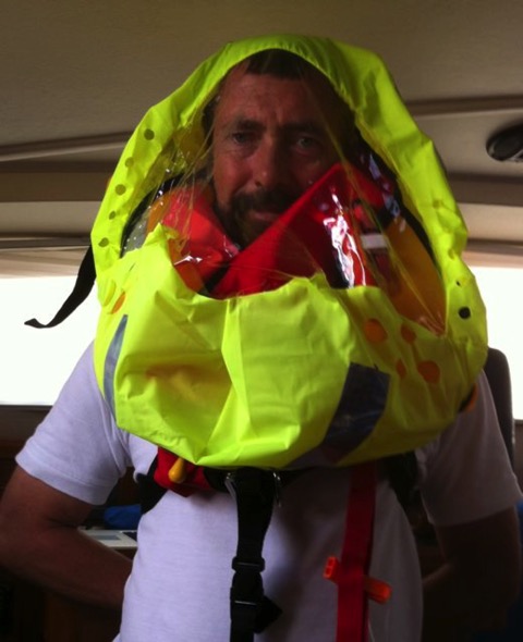
The ARC has a requirement that lifejackets be fitted with face shields, so we will pack these into the lifejackets… very fashionable?
Test Sailing
Today we got off the dock and got the crew out for a test sail. Longtime Maltese friend Anthony (racing sailor and expert rigger) was happy at the helm getting the feel of Distant Shores II.
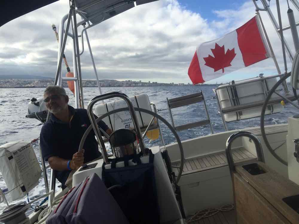
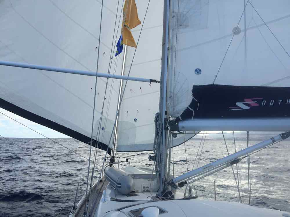
With light following winds forecast for the first leg to Cabo Verde Islands we wanted to test our new downwind rig. The main is out to starboard with a preventer. The genoa is out on our carbon pole. We wanted to also use our smaller jib out to starboard so we put a new fitting on the boom so we could use a snatch block and run a temporary sheet - essentially using the main boom as a pole to hold the jib out. Working great!!
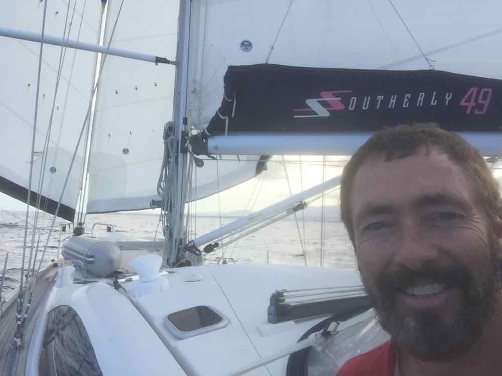
I think we'll get to use this rig coming up!! Happy Skipper!!
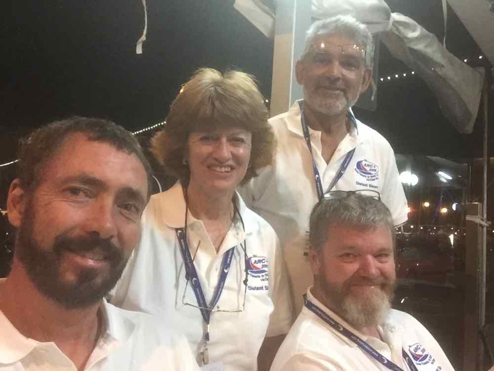
Last night was the ARC Gala party as ARC-Plus is setting off on Sunday, and ARC boats are arriving now setting off in 2 weeks. Las Palmas put on a great party, even with dancing girls and stage acts - seen here posing with their "costumes" yes thats just paint!

Happy crew nearly ready to go!
IridiumGO Review for Cruising Sailors
Do you want to stay connected while at Sea? To send photos back home from your adventure? Email, social media, weather info and more? This is now possible (with conditions)!! Read on…
For most of our 26 years of cruising Sheryl and I have kept in touch and got our weather forecast updates through our SSB and Ham radio. Voice forecasts and radio nets provided basic communication and updates to the weather so we could make weather routing decisions.
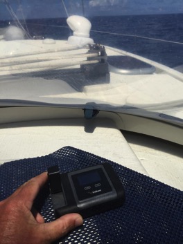
Now that satellite communications is available we can do all that and more through a satellite internet connection. But its important to realize that satellite is naturally going to be slower and more costly than the modern 3G and 4G connections we have become dependent on ashore. The question is - does it meet your needs?
Our first try at Satellite communications at sea was back in 2012 when we bought an Inmarsat handset for use in the ARC. Used as a phone it was quite acceptable, but trying to make it also work for data was frustrating. We had hoped to receive GRIB files at sea but had very little success. One day we spent $25 on “data air time” and didn’t receive anything. Admittedly this was not what it was meant for but an overenthusiastic dealer promised more than was really workable.
After the passage we didn’t use the unit again…
Fast-forward to 2015 and we’re getting ready for our next ocean crossing. I’ve heard about the IridiumGO unit which sounds like the perfect device designed for data and voice, and with an “unlimited data” plan so you don’t have to worry about high per-minute data charges. Since we planned a big passage-making year with 2 Atlantic crossings, we decided to try it out.
What is IridiumGO?
The IridiumGO is a hotspot that lets you access the Iridium network for satellite communications. Your smartphone can make phone-calls, and apps on the smartphone can access email, texts, data, weather and more. There is an App to compress and send photos, and, probably most exciting for us is the Predictwind App that lets us get weather routing and GRIB files (more on this to follow in an upcoming review).
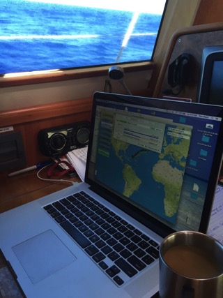
What it isn’t…
IridiumGO uses a data connection via Satellite that is quite slow - just over 2kbs. This is quite a bit slower than "dialup" as you may recall from a few years ago. You cannot “do your banking” or browser the internet. So although this is for us ocean sailors a revelation to connect to the internet at sea, it is at a speed that will not allow normal use of the internet we have become accustomed to ashore with 3G and 4G cellphones. Having said that, it is a REVELATION to be in touch offshore, as anyone on a passage can attest. We were able to send photos, texts, emails, position reports and access very high quality weather info (through the Offshore App from PredictWind - purpose-designed to work with the Iridium GO! )Photos
Sending a photo from Mid-Atlantic is something that was high on our “like-todo” list (our business is to film and document the cruising life). Iridium-GO has a photo sending app built in that neatly compresses photos down to a manageable size (20-40KB) and sends them as an email. We tested this MANY times and it was quite reliable - taking just a few minutes to send one.Texts
We do not send a lot of texts, but we did test this and it works fine.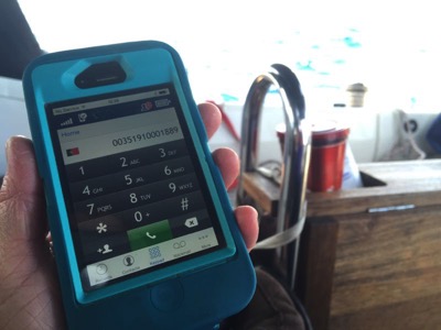
Telephone calls
Very handy and quite amazing. Suddenly my iPhone can call from anywhere. We made perhaps 20 phone calls so far and have not had any problems. Call quality was excellent! Although I had worried about delay, we found calls had an almost imperceptible delay. We received a few calls just fine as well. Magic that now our cellphones can now work anywhere! Below is the Iridium Phone app on Sheryl's iPhone as we call ahead to the marina in Flores Azores.GPS Tracking
IridiumGO can transmit regular position updates so friends and family can see where you are. We used this feature to display our position with a map right on our website. Predictwind offer this on a neat website interface all ready to go. Check out our last 3 month of cruising here on our homepage!What Does it Cost?
IridiumGO units are sold through resellers such as Predictwind, and our test unit from them included an external antenna, connectors and cables etc - on sale now for $1150. Then you need a connection/airtime package from Iridium. We had the unlimited data plan for $125/month.The Bottom Line
We recommend the IridiumGO to be in touch, send photos, email, twitter and get weather information. With the "unlimited data minutes" plan you can do all this without incurring a huge bill. It revolutionized the ocean passage for us and we look forward to our next passage - staying in touch!
Offshore - Diving on the Prop
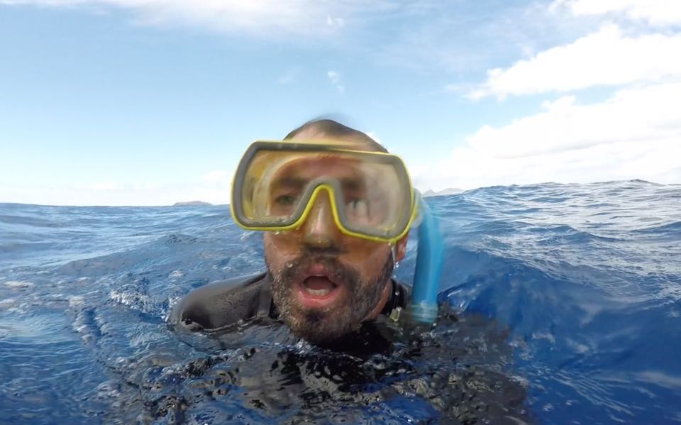
Offshore! We got a net caught on the prop as we were halfway to Porto Santo...
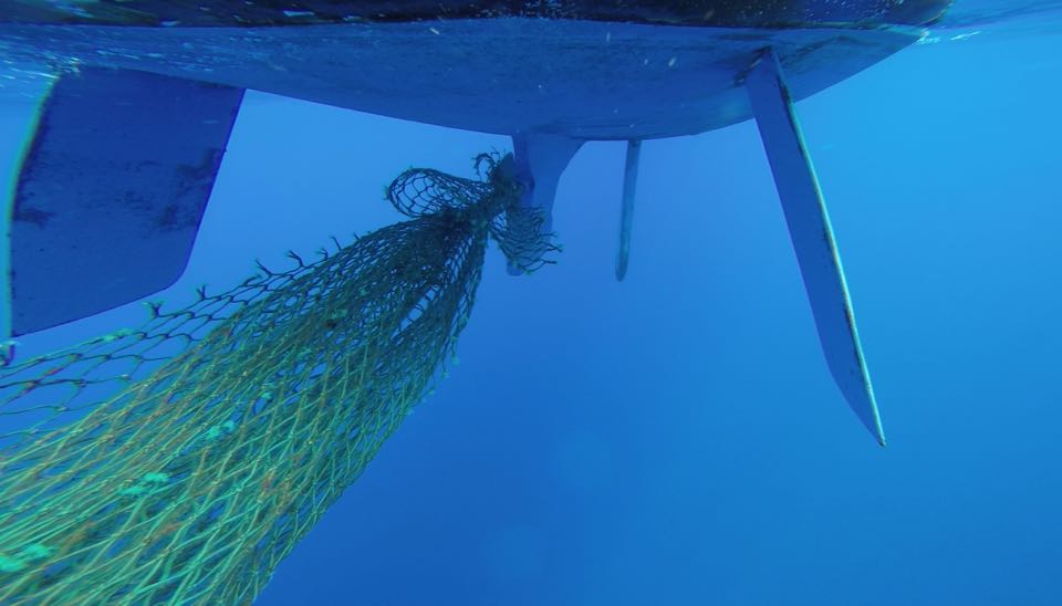
Rolling ocean swells mean you have to be careful not to get hit with the boat as you dive in clear blue water... I wore my weight belt and wetsuit so I would have protection against scrapes, and neutral buoyancy so as not to be coming up against the bottom. Some people have recommended a bicycle helmet for added protection but I haven’t tried this.
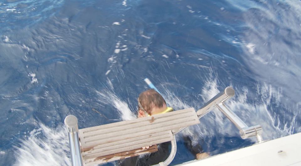
Offshore deep water - you can see Porto Santo on the horizon in the background!
The net was visible trailing astern…
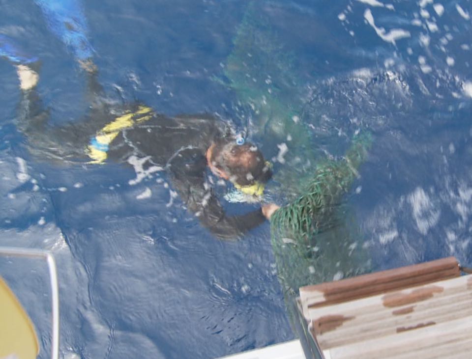
There might be a lot to cut through if something is wrapped tightly around the prop, so I usually dive with a divers knife on my leg, or a folding knife - but be careful with knives as the boat is bouncing…
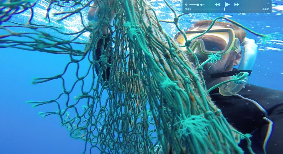
Under the boat you need to be careful not to get hit by the boat/prop/rudders as the boat moves in the swell. My weight belt gives me neutral buoyancy so I don't float up into the boat. When I was down there it was easy to see how to untangle it without needing a knife to do it.
If you are not comfortable holding your breath underwater you might consider a hookah-style apparatus or small pony tank. But be sure to practice with it before heading offshore when you might need it.
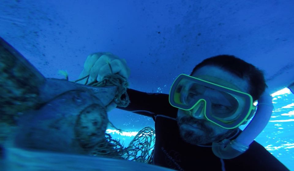
But as I got it off the prop I got slightly tangled in the net and then it got away from me... so its still out there floating…
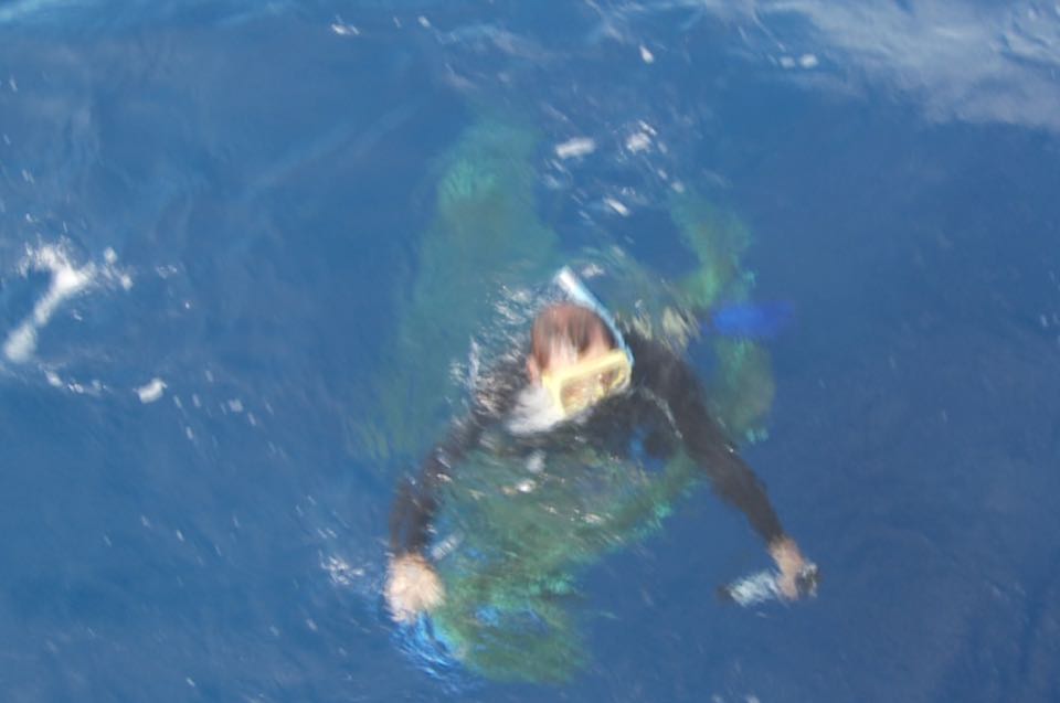
Happy ending!
The net came off the propeller - and we even managed to film the whole operation!Sailing Polar Performance
By Paul Shard, Copyright 2015. All rights reserved.
We have a lovely sunny day with light winds of about 6 knots on the beam. We are sailing at just over 5 knots. Is this fast enough? According to our polar performance data it’s not as quick as predicted. What is polar performance data? If you’re wondering if it relates to the “north pole” and what this has to do with sailing then read on :-)
Polar Sailing Data
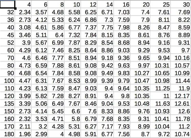
For any given point of sail your boat could potentially make a maximum speed with the sails set perfectly in specific conditions. It is useful to have this information and we can use it to compare boats, plan passages and more. To do so we need to organize lots of data for various conditions and points of sail for our specific boat.
This can be quantified by making a table of the true wind angle, true wind speed and achievable boat speed. It is commonly described for a specific wind angle like this…
90 degrees - Wind speed 6 knots - Boat speed 6.5 knots, Wind 8 - boat 6.8, wind 10 - boat 7.0, wind 12 - boat 7.1 etc
So a table might look like this showing winds from 4 knots up to 30 knots along the top row and wind angle in degrees down the left side…
Polar performance can also be graphed in a polar diagram like the one below out of the brochure for our Southerly 49.
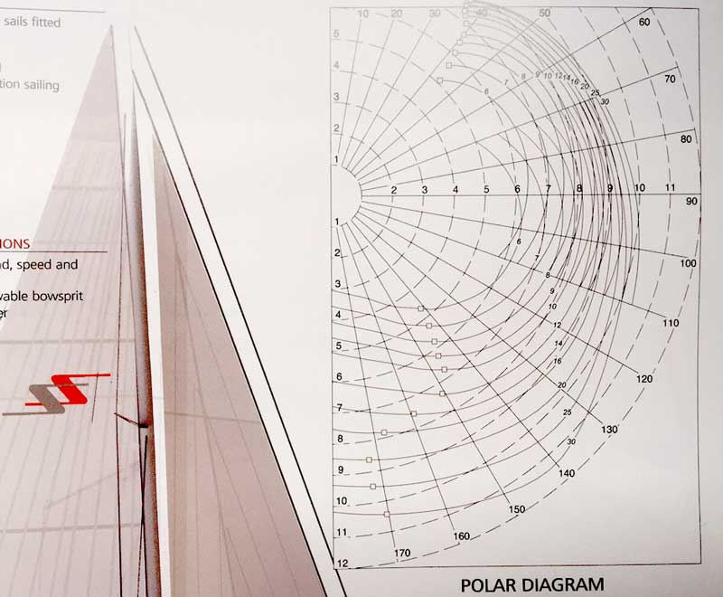
Theoretically with True wind 6 knots at 90 degrees we will make 6.4 however we make just 5.3. I think that's quite good for such light wind but it's a knot slower than we might in theory. Routing software can only suggest a good route if it can estimate where you might get to with your boat's actual achievable performance.
How to make polar performance data work for me!
Polar diagrams are calculated in a theoretical world with a clean bottom with no drag (no prop too) flat seas and perfect sails set perfectly. Our polar diagram includes us using a asymmetric spinnaker on a pole - an option we did not purchase so we will never achieve numbers so good when in those conditions. Also we will set sails and reef to suit our conditions and short-handed crew.
Routing programs usually allow us to set a "factor" to downgrade this to take into account the difference between the the perfect world and our real conditions. So setting this to 80% may get us closer to the mark. Our 6.7 knots we should be making will be reduced to match our actual performance of 5.3.
Then the program gives us a reasonable estimate that we might expect 8 more days on passage before we arrive at Flores. We are not racing after all and I had always wondered what this famously light wind passage would be like.
Out here in our high pressure world of endless sapphire seas, flying fish and tropical breezes we will sail gently on and enjoy this world that we as sailors are so lucky to experience!
Polar Performance Sailing Suggestions
- Try pre-made tables if available. You can modify them to suit your achieved performance using them as a starting point.
- If no performance data is available you might find a table for another model that is similar to your boat.
- Record your sailing performance as you are out in a variety of conditions - perhaps you can improve the tables by downgrading your pre-made table to reflect your cruising reality (older sails, conservative decisions, to much gear stowed on deck etc)
- Examine “close hauled”. This was one situation where tables seem inaccurate for us. We cannot point as well as theory and tables suggest. We have 4-6 knots on the nose so want to be close on the wind. I tweak all I can but just get 27 degrees apparent. Pretty good I think but nowhere close to what our table predicts. We should make 19 degrees AWA (apparent wind angle) which is 32 true. If we use this with the routing software it will have making unrealistic headway.
- Garbage in, garbage out. The best routing solution from a weather router to software like Predictwind or others will only be able to suggest a good route if they know how fast you will sail in different conditions and headings. With proper polar data these routing services are a great idea (routing Blog to follow!)
- Polar performance data from the boat manufacturer is quite likely to be somewhat optimistic. They are trying to sell boats and show just how well a model could perform IF everything was perfect. This is not how we will sail shorthanded on the ocean with the boat loaded for a 3 week crossing…
Order the Super Pack on DVD and get Season 1-10 Downloadable.
Order the Super Pack on Vimeo and we will send you the code for Season 10 as a bonus.
Last Minute before an Ocean Passage
By Paul Shard, Copyright 2015. All rights reserved.
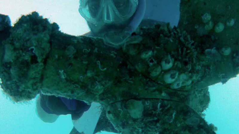
It's amazing how many little things are on the list when you are getting ready to do a big ocean crossing. The passage across the Atlantic - Caribbean to Azores - is over 2200 miles. It’s going to take us more than 13 days, perhaps 15 or 16, more than 2 weeks out of sight of land. We don’t want any important items left on the to-do list when we cast off in a few days. I still have a few small rigging jobs to do (lazy jack line replacement, taping up spreader ends etc) I need to look over the engine again, I have to clean the propeller and finish cleaning the bottom and a number more items…
The modern sailboat is a complicated machine with thousands of parts and they should all be working well before setting off to sea. But making a big crossing where there are no possible stops it is even more important. Is everything in good shape now? Do we have the proper spares if anything goes wrong? This week there have been the sobering reports of a number of boats lost at sea en route to the Azores in heavy weather. It brings into sharp focus the reality of setting out on an ocean passage. It is a serious business crossing an ocean. We want to be prepared as well as we can and make a safe crossing.
One of my jobs here in the last few days is to get familiar with the new Iridium GO unit and PredictWind software we are testing on this passage. The unit arrived yesterday and I will get it configured and practice with it over the next few days. I am especially interested in trying the PredictWind feature to help plan your departure date. Using a polar diagram (chosen from a list of common boats) to approximate our performance, the software calculates routes and times for the passage over 4 different departure dates. See the slide below… This shows recommended routes for the next four days. Note we are at the very outer realms of forecasting ability asking the software to calculate 2 weeks in advance and in fact the later departure routes do not quite complete since the forecast doesn’t cover the 18 days needed to calculate however en route we will be getting daily weather updates via the PredictWind app and the GO unit. This is just for planning and when we are at sea we will be using the routing tools to fine-tune our course. Initial impressions are that this will be a valuable tool.
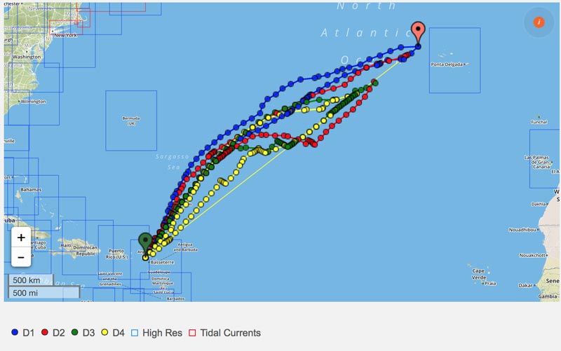
There is also a table generated showing how much of your time is spent in different conditions, for example “% time reaching” ranges between 62% and 93% depending on which weather model and departure date is chosen.
| D1 | D2 | D3 | D4 | PWG | PWC | PWG | PWC | PWG | PWC | PWG | PWC | ||||||
| Start Time | 10 May 12:00 | 10 May 12:00 | 11 May 12:00 | 11 May 12:00 | 12 May 12:00 | 12 May 12:00 | 13 May 12:00 | 13 May 12:00 | |||||||||
| Passage Time (days) | 13.7 | 13.2 | 12.9 | 12.9 | 12.0 | 11.8 | 10.9 | 10.9 | |||||||||
| Max wind speed (knots) | 18.6 | 19.5 | 22.5 | 18.6 | 23.6 | 16.2 | 20.8 | 15.9 | |||||||||
| Min wind speed (knots) | 2.4 | 3.2 | 1.7 | 1.7 | 3.8 | 2.0 | 3.4 | 1.5 | |||||||||
| Ave wind speed (knots) | 11.0 | 12.4 | 13.7 | 10.6 | 14.6 | 10.7 | 12.0 | 10.3 | |||||||||
| % time upwind | 22% | 2% | 25% | 5% | 35% | 8% | 43% | ||||||||||
| % time reaching | 74% | 71% | 72% | 83% | 62% | 88% | 54% | 93% | |||||||||
| % time downwind | 4% | 27% | 3% | 12% | 3% | 4% | 4% | 7% | |||||||||
| % time < 8 knots | 29% | 16% | 7% | 27% | 5% | 20% | 17% | 15% | |||||||||
| % time 8 - 20 knots | 71% | 84% | 85% | 73% | 79% | 80% | 81% | 85% | |||||||||
| % time 20 - 30 knots | 7% | 16% | 3% | ||||||||||||||
| % time 30 - 40 knots | |||||||||||||||||
| % time > 40 knots | |||||||||||||||||
| % time < 1m swell | 25% | 47% | 28% | 45% | 22% | 49% | 23% | 51% | |||||||||
| % time 1 - 2m swell | 75% | 53% | 72% | 55% | 78% | 51% | 77% | 49% | |||||||||
| % time 2 - 3m swell | |||||||||||||||||
| % time 3 - 4m swell | |||||||||||||||||
We are also hoping to get the Iridium GO unit to produce a tracking map of our route in real time! I will get this installed on our homepage so you can follow along if you like. Hopefully we will have all our jobs done by Wednesday and will be setting off shortly after that.
Bon Voyage!
Of course the best way to follow along on our voyages is by watching the Distant Shores Television series! Not in real time but we document our journeys and share destination hints and tips. The whole series is now available for download on Vimeo. See you out there!

Order the Super Pack on DVD and get Season 1-10 Downloadable.
Order the Super Pack on Vimeo and we will send you the code for Season 10 as a bonus.
Transatlantic Passage Planning
By Paul Shard, Copyright 2015. All rights reserved.
Weather Research
May and June is generally acknowledged as the best time to cross West-East and has the advantage of arriving in the Azores in spring/early summer when the islands are arguably at their best. Starting from the Caribbean as we are means we don’t have to cross the Gulf Stream or worry about that - we will be looking for a forecast with E or SE winds so we have a nice few days at the start and head N-NE so we will be on the north side of the Azores High. Hopefully this will mean following winds as we turn eastwards around 30N. Check out Jimmy Cornell’s excellent book World Cruising Routes for recommendations of the passage you are considering.
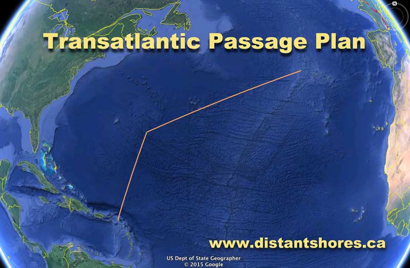
Weather Planning
With just a few days to go we will fine-tune our departure forecast using passageweather.com and our weather routing software to plan a specific route. Check out my blog on the weather routing app Weather4D
Rigging Check
We had local St Martin riggers FKG look over the mast tuning a couple of weeks ago but I will be up the mast carefully checking spreader ends, masthead, chafe etc. With a hopefully large downwind component to this passage I will be adding some rigging tape on the back of the spreaders to reduce chafe if we have the main all the way out. I will set out the downwind pole and check all components of that setup to make sure its all in order. Lubricate all cars and check blocks are turning freely etc. Make sure all turnbuckles are taped and in good order. Lubricate the gooseneck and furling gear.
Provisioning
Sheryl will be laying on some great food for this passage I think :-) Her plan is to pre-prepare portions of repeatable meals to be frozen. With a day to go we will be buying fresh produce and final stocking up. Check Sheryl’s provisioning blog here…
Mechanical Check-up
Lights, Radar, AIS & Navigation Equipment
I did a plotter software upgrade a few days ago and have been looking it over to make sure we are familiar with new features. I will also check all lights, test the radar, confirm our AIS is transmitting and generally make certain our nav systems are up and running.
Filters
I will check and empty our seawater strainers, and clean the knot-log impeller.
Bottom Check
I will also swim the bottom 1-2 days before we set sail. Barnacles grow prolifically here in the Caribbean and everything seems to especially enjoy life in the St Martin Lagoon :-) so I will make sure we have no unwanted growth slowing us down before we set sail. Even a small amount of growth could slow us 0.5 of a knot. But 0.5 knot equals roughly 1 day slower passage…
Happy Hour
Tempting as it is to celebrate departure with a big party the night before we find that can make crew more susceptible to seasickness. We will have a nice dinner the out a day or so earlier, then the evening before departure we’ll have a more restrained meal and an early night to make sure the crew is in top shape for the adventure ahead!
Departure
We like to leave around noon if possible for a longer passage. We have a few hours at sea in full daylight to get clear of land and get into a bit of a routine before the first night watches. It will take a few days to get into the rhythm of life at sea and this is a good way to start off!
Travel the world with us aboard Distant Shores
Order the Super Pack on DVD and get Season 1-10 Downloadable.
Order the Super Pack on Vimeo and we will send you the code for Season 10 as a bonus.
J&K Via Facebook“It’s because of your first season that we took off to go sailing and meet new people. 45k miles later, we're more indebted to you than ever. Thank you!”
When to Abandon Ship?
By Paul Shard, Copyright 2015. All rights reserved.
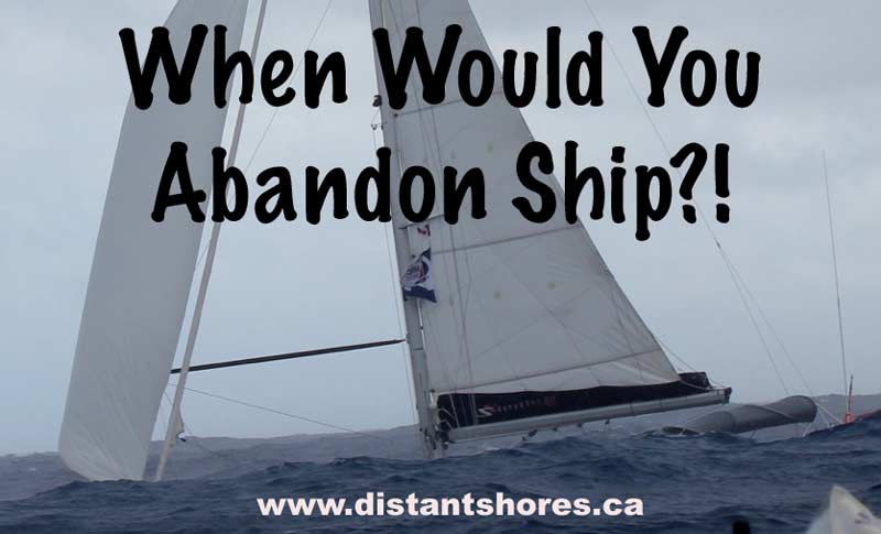
When would you abandon your boat? What set of circumstances would have to occur for you to call for help and be rescued leaving your boat adrift in the ocean?
Recently there have been a few high profile incidents where cruising boats got into trouble, distress calls were broadcast, the crews successfully rescued and the boats were abandoned although they were floating. It got me thinking about that most terrifying of situations, having to abandon the boat.
In the mid-eighties as we were preparing to set sail, we read advice about dealing with storms, keeping the boat afloat, collision systems and heard phrases like “step up into your life-raft” - in other words don’t get up into your life-raft until the boat is sinking beneath your feet.
When we started cruising in 1989 we made easy passages heading south on the coastal route to the Bahamas before tackling an ocean passage to Bermuda the next year. Then when that went OK we felt ready to try a bigger crossing - our first Transatlantic - and ran into our first big gale. A front was stalled near Bermuda and we thought we could outrun it en route to the Azores. But it caught us and we had winds 40-50 knots with 25 foot seas for a couple of days. Our autopilot was not able to steer in the big seas, waves boarded and tore away much of our cockpit canvas, we had leaks in the forward hatches, the bilge pump was cycling regularly, both of us were quite seasick and we were dealing with by far the largest waves we had ever seen.
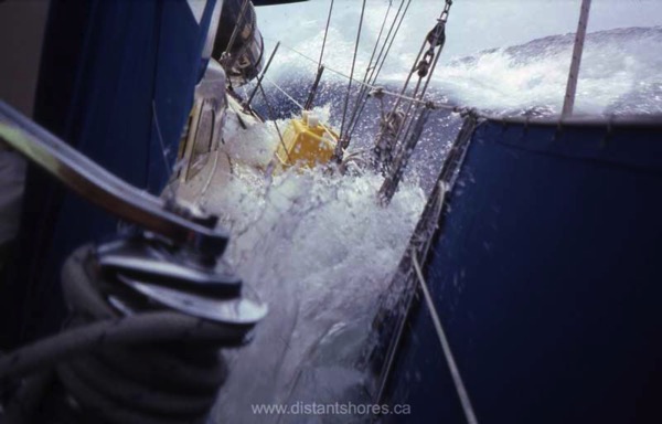
Did we think of abandoning ship? Well no, but if you had happened by with a helicopter you might have got a deal on a 37 foot boat right then :-) But as the weather continued we dealt with the problems, hove-to for about 24 hours and finally got back underway. This was in May 1990 and we had faced one of our big fears - a storm at sea. We’ve faced many large storms since then but this is the one that tested us the most.
Here is an stormy video excerpt showing big seas - not the biggest - but pretty big...
In the last few weeks there have been two incidents of sailboats abandoned not far from where we experienced our first big gale. The remarkable story of the 43 foot Sedona, purchased on Ebay for $10K. She set off in February (on Friday 13th) from Rhode Island planning a voyage to Australia? (Seriously) Winds of 40 knots tore her sails and with engine problems they activated their EPIRB. By the time a Coastguard helicopter arrived conditions had worsened and the rescuers braved 60 knot winds and 25 foot seas to lift the father and son crew off the boat. I am glad everyone is OK after the rescue. There were no injuries.
The skipper is quoted as saying, “Most people assume we set off the EPIRB because of the storm. That had nothing to do with it. We were stuck dead in the water unable to move it.”
So here is a situation where the engine isn’t working and the sails are torn. Undoubtedly there were other problems too. But was it time to abandon ship?
Beam me up Scotty!
In Star Trek it was quite a simple job to jump out of a troublesome situation and suddenly be beamed back aboard the Enterprise. But today’s reality is a bit more difficult. Coastguard rescue personnel risk their lives every time they are called out. Rescue swimmers jump into freezing waters and risk getting tangled in rigging to get people off stricken vessels. It is not as simple as a request to be beamed up. It is pretty dicey to be pulled off a vessel at sea. A rescue transfer to a freighter will likely involve being dragged in the water, possibly being banged against the hull of the ship as you are winched aboard. There are risks involved with being rescued too.
Aboard Distant Shores II
When Sheryl and I sail across oceans we have always assumed there could not be a helicopter rescue. We would have to climb into our life-raft, and frankly even the best raft is something like a kiddie pool with a roof (and no means of propulsion). Our plan has always been to do everything we could to keep the mother ship afloat. The advice is to “step up into your life-raft” meaning your boat has to be actually sinking so low that it was a sure thing you would need to abandon ship. We do everything we can to prepare for emergencies and to try to prevent them. We plan passages in the seasons when they are not likely to have terrible weather. I think there would be certain passages we would just not attempt - such as leaving in January from the coast of the northern USA. And if we did have to do that for some reason I think we would have, at the very least, a sturdy storm sail set up ready to go.
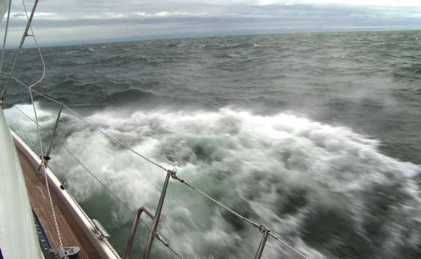
Hope for the Best but Prepare for the Worst
Making a passage plan, even with a good weather forecast will involve planning your best case scenario. But it is essential seamanship to have plans for what to do if everything doesn’t go as hoped. “If we leave tomorrow beam winds mean we will probably spend three days at sea.” What if you have a problem with your jib and end up sailing just 3-4 knots instead of 6 knots. Will you get into a storm because you are sailing slower than planned? Then you would need to be prepared for being in a storm. Will you be able to heave to or fore-reach to wait as the storm passes? If the engine were to fail for some reason, would you have a way to generate power, or would you be prepared to hand-steer without the autopilot? If not perhaps consider an additional crew member to help with duties. If you’re dismasted do you have extra food and supplies for a lengthy passage at sea under jury-rigged sails?
Think through some possible problems - fire, engine failure, rigging problems, seasickness, autopilot problems? For example, taking on water. Do you have a bilge alarm set up so that you are warned as soon as any water comes into the boat. Do you have a collision blanket or other plans to temporarily plug a hole. Check out my blog on installing a Bilge Alarm here.
And do you do a thorough safety check and get re-familiarized with all the safety equipment you carry on board before heading offshore? Do you know how to use your EPIRB? Do you and all members of your crew know the procedure for making a distress call on the radio? When participating in the World Cruising Club’s Atlantic Rally for Cruisers (ARC) in 2012 on our 5th transatlantic crossing (which we documented in three half-hour episodes in season 9 of the Distant Shores sailing TV series), a thorough safety check was carried out on each boat. Here’s an excerpt showing the steps involved…
When Should You Abandon Ship?
So, what would it take for you to abandon ship? I welcome your comments below.
Addendum: PAN PAN or MAYDAY
See Andy’s comments below - sailors rarely use the PAN PAN call. If a situation of urgency exists but not immediate danger to anyone’s life or the vessel itself, then PAN PAN is the correct call - not MAYDAY. For example, our mast has fallen down, we have cut the rig away and we are safely floating but not under way then we should call a PAN PAN. We are not about to climb into our raft since the boat is floating, but we should notify Coastguard of our urgency. Perhaps we will not be able to affect repairs and might need help. However there is no immediate danger to life or the vessel itself.

Weather4D Passage Routing Review - Updated
By Paul Shard, Copyright 2015. All rights reserved.
Scroll Down to see update following the passage
Do you wonder about the best way to plan a passage? Ask yourself questions such as “Can I make a passage before the next front comes in? How long will it take? When is the best time to tack, assuming the weather will be coming more from the east in the next few days?”
These are questions Sheryl and I have been asking ourselves since we are planning a big jump directly from the Exumas in the Bahamas down to Saint Martin in the Caribbean this week. It’s usually a tough upwind slog so planning the best day to leave might make all the difference between a tough bash to windward and an enjoyable passage. If we can catch a window where a front is approaching, we will grab the winds that go to the northwest and north which might allow us to make the necessary easting until we turn right and pick up the tradewinds from the east down to the Caribbean. This is the traditional strategy for this passage.
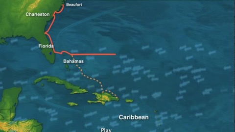
I have always done this planning using a manual method. I look at GRIB files and step through the passage – updating our course and guessing how many miles we will make in the next day. If the wind is on the beam we might make 7-8 knots – perhaps 175 miles in 24 hours. By then the forecast might predict winds a bit more on the nose so we will be slowing a bit.... hmmm. So perhaps if we leave a little earlier and motor a bit the first day we might pick up the winds so we get away from the weather...
Does this sound familiar? Or does the whole routing thing sound too complicated? What to do??
Weather4D Routing Software
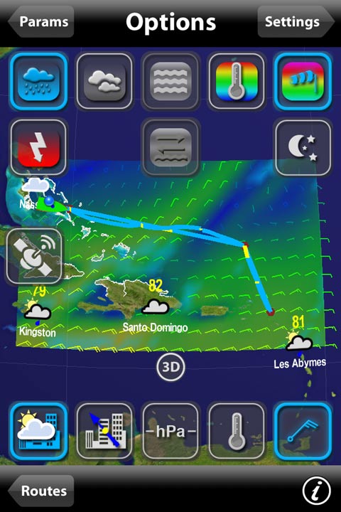
How about an app that does the weather routing scenarios for you? Plus figures out alternative options for your course. Just plug in a start date, define the weather area you want to load for the GRIB file and Voila! (that’s French for “there you are!”)
I have been testing out an app called “Weather4D” and related app “iPolar” on my iPhone. A bit complicated at first but quite a revelation in route-planning. Let’s jump in!
Weather data can be displayed on many websites and using GRIB viewers so you can watch the weather animate through time over your upcoming route. But in these cases you still have to do the actual route planning. You will need to plot a proposed course and plot waypoints based on how far you think you might sail each day.
More Than just a Grib Viewer
Weather4D is not just a grib viewer – but so much more. It will do routing – advancing you along your planned course so you can visualize the weather as you will be making your passage. But how can it do that? How will the app know how fast we will be going?? For that you need the info on how fast you can sail on each heading relative to the wind. This is often represented by a “polar” predicted performance diagram.
Polar Performance Data
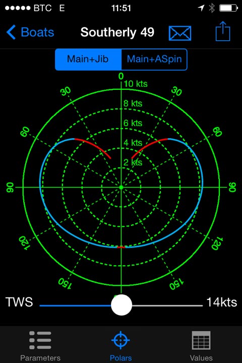
You can import Polar performance information for your own sailboat into the Weather4D app. I used the companion product called iPolar to generate a predicted polar sailing table by inputing LOA, LWL, beam, displacement and our Southerly 49 sail areas. Here is a capture screen of the diagram (showing the 14 knot performance set by the slider underneath). It appears to be fairly close to the polar diagram Southerly published for the 49. Good enough anyway to give a reasonable input for the program.
Before I get into much more complicated descriptions – here is a nice graphic to show why its all worth it. Weather4D has calculated how much we will be sailing along our planned route (red boat), and even generated a better suggest route (green boat).
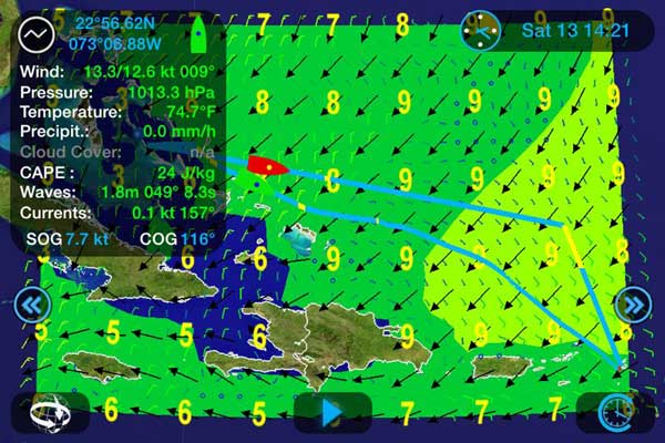
This is a scenario of our upcoming trip from the Exumas (upper left) to Saint Martin (lower right). We have just started and you can see our boat in red following along the route I input. Using the polar performance data we put in, Weather4D is applying the GRIB file data and sailing us along my course.
Wind and wave data is displayed on the panel – and I have set the screen to display the waves as background shading. Winds are the small arrows, waves are the black arrows.
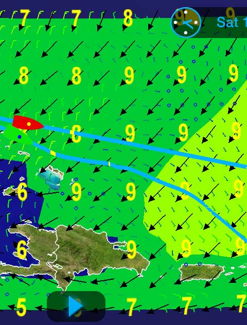
However, notice the second route, also in blue but below my planned course. The green boat is the routing simulated alternative. This route is the optimum course calculated by Weather4D. Note below how (if all goes according to forecast :-) we might arrive earlier by the route the Weather4D routing algorithm is suggesting. The green boat is coming in more than 6-8 hours earlier!
The two routes compared: If we follow my route we will have a slow section (in yellow on the right side of the screen) where the winds are too light to make a good speed. Note the suggested lower route has much less yellow section.
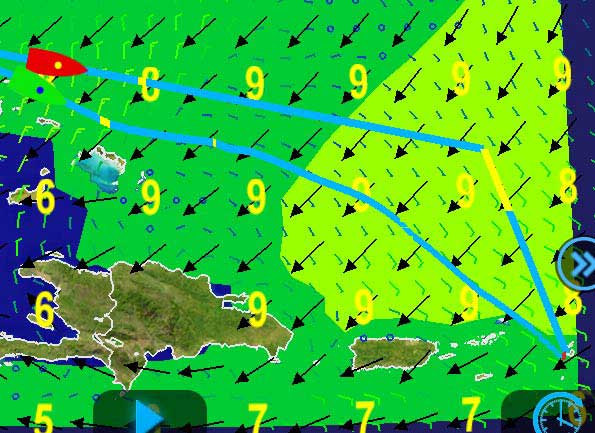
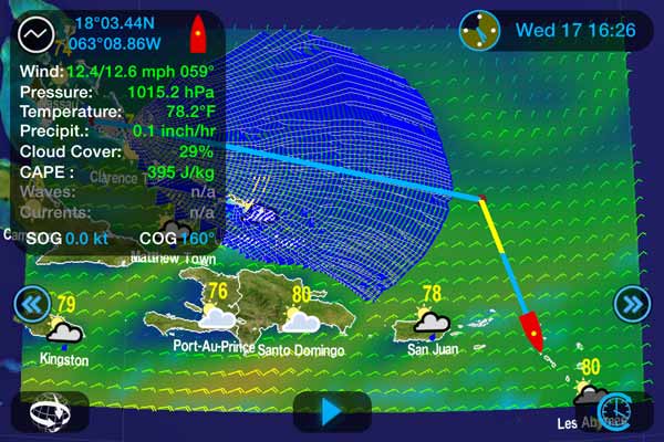
Weather routing is tough work and very “CPU-Intensive”. It takes a minute or so to calculate our best potential route. This is on an iPhone 4 so newer phones would be faster - I would recommend using this on a new iPad - Christmas is coming :-)
Here I snapped a screen-shot of the process... potential routes are being evaluated as time advances. You can see the far northern options aren't getting us so far as the southern options so it is concentrating more on them.
This will be an ongoing review and I will update it when we arrive in the Caribbean with our thoughts after the passage.
Weather Routing Software - Competition
Predictwind is $199/year and MaxSea has a weather routing module you can add in for $260. Although it might well not do all these packages can, Weather4D at $33 (plus 10.99 if you want iPolar) seems to be a useful package to run on your tablet or smartphone. We will report back on the passage experience when we arrive in Saint Martin in a week or so.
Has anyone got experience with Weather4D or the competing Predictwind Service or MaxSea? Please chime in with comments!
Update Dec 21/14 - Choosing the Route
Greetings from St. Martin! What an amazing passage we just had sailing from the Bahamas! Looking at the suggested route above I decided to modify our route a bit south and plan one that would take us more directly to St Martin... see below for the plotter track we did on our Raymarine chartplotter which uses Navionics charts. This is our actual track in black, with red dots for log points, noon fixes etc.
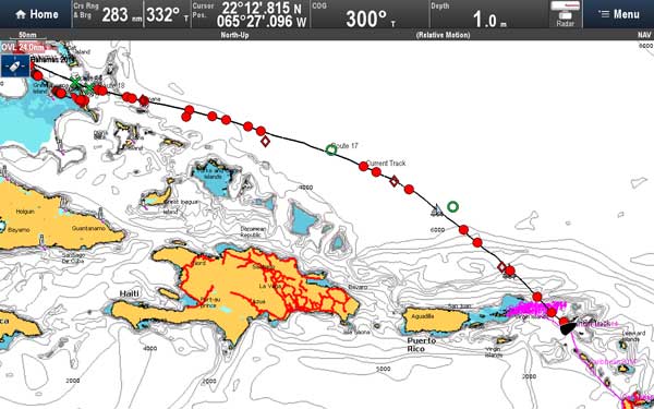
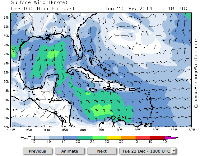
I know that winds in this area rarely come from the south so I wanted to stay further north in case our predicted N-NE winds didn’t last as long as the forecast said (which was that they were to swing more NE-ENE at the end of our passage). Here is a typical weather pattern for this time of year - lots of easterly winds - no chance of making the jump we just did.
Grab Your Weather Window
So how do you plan a successful passage? There are so many amazing tools we can use nowadays that it is much easier than it used to be to help plan a reasonable route for your boat and your crew. I will definitely be adding the regular use of the Weather4D tool to my passage planning routine from now on.
- Check general weather patterns if you aren’t familiar with the area... See Pilot Charts, cruising guides and general routing ideas such as Jimmy Cornell’s World Cruising Routes.
- Check the current situation with sites such as Passageweather
- Roughly evaluate your proposed route to see if you will have acceptable weather scenarios for your trip by drawing it out on a chart advancing your position by typical day’s run (judging from the forecast winds and seas)
- Simulate your route using Weather4D.
- Set Sail!
Thoughts on Weather Routing
Success of the weather routing will depend on 2 major factors...
The accuracy of weather forecasts - obviously less accurate the further out the forecast is. Your own boat and crew’s ability to meet your predicted performance.
Weather Forecast Accuracy
In our case the forecast we received turned out to be quite accurate right up to our arrival as the winds had shifted to NE-ENE by the 5th day. 12 hours into the passage we passed Rum Cay in the Bahamas and our Cellphone data link got a weather update but after that we had no more data connection. This meant we could not receive an updated grib file for Weather4D while we were underway but we did receive audio forecasts on our SSB radio.
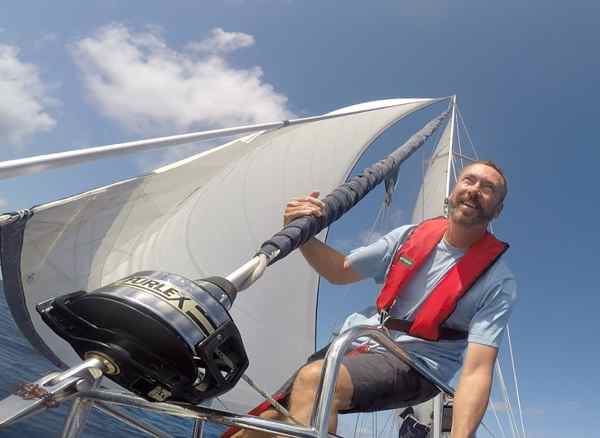
Polar Diagram and Predicted Performance
Did we meet our predicted speeds? Well, mostly :-)
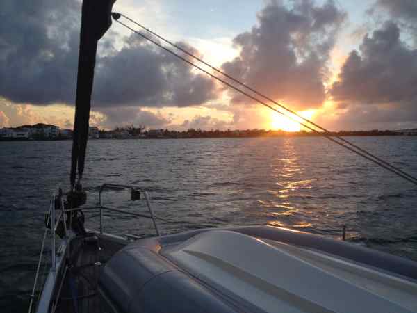
We regularly make 7.5-8 knots sailing on a beam reach and with steady winds we made progress as predicted. But the perfect world of Polar predicted performance doesn’t take into account normal wind fluctuations and a short-handed crew. With just the two of us on board there were a few occasions where we wouldn’t sail at our peak. For example, we will not use our big genoa with winds over 20 knots, so if it's evening and there are occasional gusts over 20 we will furl our genoa and put out our smaller self-tacking jib. This is a tough little 100% jib and it is quite capable of handling winds well above 20 knots so we can have a more relaxed time on our night watches. But this means we are sailing at 6 knots or so as the wind might be just 13-14 kts. If we had a racing crew we would be changing sails and keeping much closer to our “predicted performance”. I think if we had done this we would have come closer to the predicted arrival time. In the end we arrived at 5 o’clock in the afternoon - about 8 hours after Weather4D suggested we would get in. Still in time to celebrate a sunset in the lagoon at Saint Martin and have a nice night’s sleep.
Travel the world with us aboard Distant Shores

Order the Super Pack on DVD and get Season 1-10 Downloadable.
Order the Super Pack on Vimeo and we will send you the code for Season 10 as a bonus.
J&K Via Facebook“It’s because of your first season that we took off to go sailing and meet new people. 45k miles later, we're more indebted to you than ever. Thank you!”
Clear the Decks
25 years ago when Sheryl and I were building and outfitting our first boat, Two-Step, we tried to imagine sailing her in a storm. As a result, we designed the deck layout so we could handle most tasks from the cockpit and bought heavy weather sails.
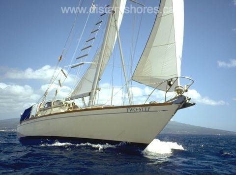
It is interesting to look back on our trip and see just how much heavy weather we encountered. In three years --1050 days of living aboard during an Atlantic circle trip -- we were under way for a total of 4500 hours or nearly 200 days full time. Of that time, 120 days were spent out of sight of land on passages ranging from 2 to 20 days in length and only 9 days were spent in heavy weather! Less than 1 percent of the cruise (8% of the time offshore) was spent in the storm conditions we had thought so much about.
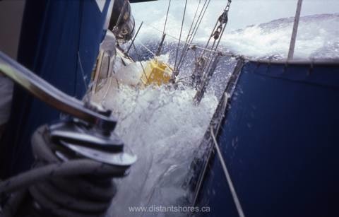
In retrospect, it might seem strange to have put so much effort and expense into arrangements to benefit us for such a rare occurrence. But the time was certainly not misspent!
The heavy sails and rigging helped Two-Step to avoid problems -- a form of insurance that paid out, without an accident happening.
And by planning the deck layout for easy single-handing, we simplified the sailing at all times.
One of the most common “on deck” problems we have seen on cruising boats is too much clutter. We fell into this trap when we left Florida on our first blue water passage to Bermuda. We bought extra jerry jugs for fuel, water and gasoline, and even an extra propane can (besides the two in the vented propane locker). We set sail with nine 5-gallon jugs, the extra propane can and some teak boards (never know when you might need them), lashed on deck. This was more than 300 pounds of weight well above our centre of gravity! Two-Step wallowed off into the Gulf Stream, taking noticeably longer to recover when the seas slapped her.
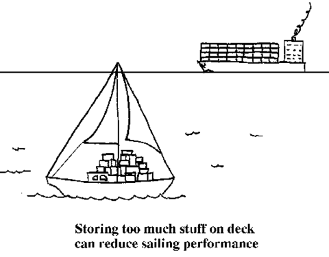
In a moderate blow 2 days later, a boarding wave tore the lashings and swept the gasoline jug and the propane can over the side. I prefer to think that I was being told to keep the deck clear. Since then we have eliminated all but two of the Jerry cans -- they each contain 5 gallons of water to be grabbed in case we ever have to abandon ship.
Nowadays on board Distant Shores II we keep the decks completely clear. Everything including fenders and jerry cans are stowed before we get underway. Sometimes I think people don't recognize us as a cruising boat because we are not cluttered enough! (Although the discerning eye will notice the wifi booster and the 20 foot high SSB antenna on the stern). Our boat performs just as well as she did when we bought her. She has no additional weight up on deck and sails better because of it.
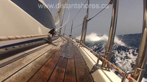
If you have plans to lash jugs on deck it might be good to check with a designer and make sure the stanchions can handle the additional force. They were designed to save people from going overboard, not to have a 2X6 board and hundreds of pounds of stuff lashed on to them. Our mistake when we went offshore overloaded on Two-Step was that we didn't really need all that stuff. We couldn't possibly need the extra propane on a passage, nor the additional fuel or water. She was a small 37-footer by modern standards but she did have enough capacity in tanks to cross oceans when set up properly.
Setting up a boat “on-deck” for long-term and ocean cruising is really an exercise in common sense. If you plan to sail short-handed, as we and most cruisers do, organizing the deck for single-handing will allow the off-watch crew to get an undisturbed rest on passages. If you plan offshore passages it is important to consider heavy weather. Preparation is the best insurance you can get.
Here is a scene from Distant Shores Season 9 with stormy sailing conditions on the ARC Transatlantic Crossing.
The O Words - Offshore, Ocean, Overnight
Many years ago a cruising lady we met in the Bahamas told me there were three words she didn't want to hear from her skipper. She said these were the O-Words - Ocean, Offshore and Overnight. The O-Words meant she had something to worry about in the upcoming voyage.
Hmmm, did my mate worry about such things? As a young cruising skipper I knew you have to keep the crew safe AND happy!
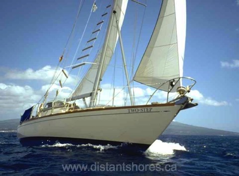
Our Classic 37, “Two-Step”, in the Azores following our third transatlantic passage.
(The voyages of Two-Step in Distant Shores seasons 1-4)
Sheryl and I were on our first international cruise when we met this lady. We'd travelled down the Intracoastal Waterway, then jumped across the Gulf Stream to the Bahamas to discover crystal blue waters, fine white sand and warm breezes. All our compatriot cruisers had sailed many miles also, mostly more than 1,500 miles, to get to this point. This cruising lady had experience but had been traumatized somewhere on that trip south. Sheryl and I were sailing on our 37-footer "Two-Step" and had been enjoying the trip taking things slowly and step-by-step building our confidence and experience. There was lots to learn but we knew it and had lots of fun. So how had we avoided being traumatized by the "O" Words?
Starting Out
Rewind 6 months… we had just begun our cruising adventures aboard our homebuilt Classic 37 sailboat and were very conscious of our lack of experience. We had both grown up with boats but powerboats, not sailboats, and following a dream of making a long-distance voyage to the tropics we had learned to sail in Georgian Bay four years prior, then had sailed a number of miles in Lake Ontario. We had even chartered in the British Virgin Islands (BVI) but we had never sailed Overnight at that point. We had sailed in the Ocean there but had not sailed Offshore. So we had only bagged one of the O-Words and since it was just sailing around the BVI perhaps it didn't even count as real Ocean sailing.
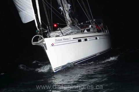
Completing our fifth transatlantic crossing aboard our Southerly 49, Distant Shores II
(Canary Islands to St. Lucia with the Atlantic Rally for Cruisers, Distant Shores season 9)
Mastering our first proper O-word came as we set sail from Toronto, Canada, in September 1989. We did our first Overnight across Lake Ontario, an inland sea with a lot of large Great Lakes ship traffic, to Oswego, New York, where we cleared into the USA and entered the New York State Canal system that led us to the Hudson River and New York City. From New York Harbour we headed out into the Ocean which we were pretty nervous about. So we didn't push. Although other more experienced sailors headed out before us we waited for really good weather and, getting up really early, sailed gently south down the coast in the Ocean in daylight hours to Atlantic City. We didn't want to combine Ocean with Overnight the first time out nor scare ourselves by trying it in rough weather. We promised one another if one of us wasn’t happy we would go back. Honouring that allowed us both to stretch ourselves a little knowing that we could count on the other to turn back if one of us was uncomfortable.
We did one more day of the Ocean sailing to Cape May, then next came the Chesapeake Bay, a wonderful cruising ground full of bays, rivers, and creeks for anchoring plus delightful towns for exploring. After making a few improvements to the boat at the numerous well-stocked chandleries there we headed down the Intracoastal Waterway in the fall of 1989. Massive Hurricane Hugo roared through in September and amongst other damages forced the closure of a bridge, and hence the stretch of ICW from Georgetown to Charleston, South Carolina, was blocked. We had been enjoying the delights of the ICW route south until this point and hadn't been in the Ocean since our quick hops from New York to Atlantic City and Cape May a month earlier.
First Overnight
I looked at the chart and with calm weather conditions in the forecast I saw the opportunity to plan our first Offshore Overnight passage. We would head out to the deepwater sea-buoys offshore and sail down the coast. Winds were forecast to be light and the seas were relatively calm. We weighed anchor around midnight and slid down the river with the tide heading offshore from Georgetown to arrive in Charleston SC in daylight. Stars twinkled overhead and smooth seas were a gentle introduction to our first Offshore Overnight sail. We both stayed up as we headed Offshore. We hadn't planned a real watch schedule for the first part of the night since it was just a few hours down the coast and I think we were both excited. We both stayed up until we picked up the outer sea buoy and then took turns napping. Now we always establish a proper watch schedule.
I think I was somewhat lucky that our first Offshore Overnight was so nice. It was a bit rougher as we beat the remaining 8 miles back inshore to the channel mouth on the approach to Charleston. But we had done it! We did our first Offshore Overnight on the Ocean and it had been the furthest Offshore we’d been up to that point. The first mate was happy and we celebrated with a dinner out in lovely Charleston. "Keep it fun for everyone!”. We both agreed that the tradition of a celebratory dinner out as a reward would make the tougher passages we might face in the future more bearable.
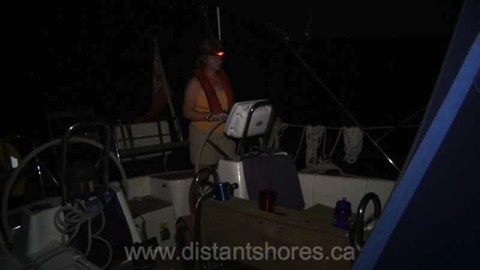
Sheryl on night watch sailing north through the Bahamas
(Distant Shores season 10)
If you are planning for your first "Offshore, Ocean, and/or Overnight” it makes sense to plan a trip that gives everyone a chance to appreciate the wonders of a nice experience. There will be time to tackle tougher conditions and rougher passage-making down the line but once your crew knows how nice it can be they will be ready to build on their experience in easier stages. The beauty of the open ocean can be worth a little discomfort, and the sense of accomplishment will help build the crew into a team.
Mission-O
Meeting more than one traumatized crewmember from other boats on that first trip south really had an effect on Sheryl and me. We could see how easy it could have been to avoid the conflicts and fears some of our fellow cruisers were experiencing by making simple changes in pace and/or attitude. From then on it became a mission to help people achieve safe, comfortable and harmonious voyages with their friends or loved ones through our writing and television programs.
On September 21st, Sheryl and I will be celebrating 25 years of international cruising together as well as the production of our 125th episode of the Distant Shores sailing TV series which features the world’s best sailing destinations and the launch of our new how-to series, “Let’s Go Cruising!”. The first DVD/download of “Let’s Go Cruising” will be about Anchoring using footage we’ve shot in many exotic locations around the world in all conditions. We invite you to subscribe to our newsletter to receive updates on this new series plus tips and advice as well as a free download of “Southern Exumas, Bahamas”, a half-hour episode from season 5 of the Distant Shores sailing TV series as a bonus gift.
Please share your experience. How did you deal with your first Overnight sail or prepare your crew for theirs?
Plan your passages around the world with us aboard Distant Shores

Order the Super Pack on DVD and get Season 1-10 Downloadable.
Order the Super Pack on Vimeo and we will send you the code for Season 10 as a bonus.
The Miracle of Radar
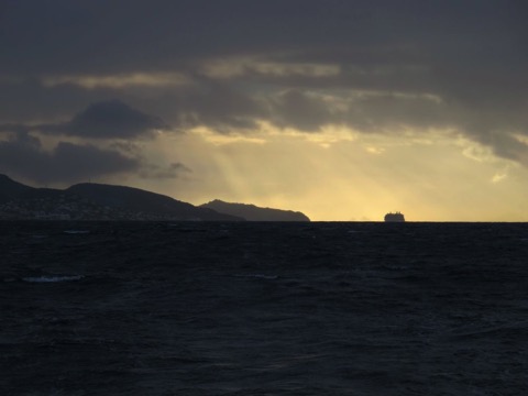
We are up in the dark and raising anchor before dawn. It is a Caribbean morning with a salt tang blowing a flukey breeze off the beach and St Martin's distinctive lagoon behind. The high bulk of the island to the east hides the orange glow of sunrise and shades us from the trade-winds. Five large cruise ships are approaching from the southwest, steaming past us toward Philipsburg. It will be busy in St Martin today. But I am looking forward to a day at sea after our time in this bustling island.
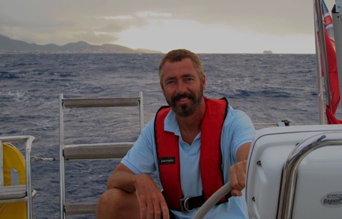
Morning reveals a grey sky, a high grey dome of clouds with isolated heavier clouds and showers marching out of the east. Perhaps we won't have our normal trade-winds today. I flip on the radar to take a look at the approaching weather. I normally use the chart mode to see showers with the radar overlaid on the plotter in purple. Zooming out to see the surrounding islands I put the radar on its 48 mile range and there are the showers, a nice soft purple splotch coming up past St Barths . Over the next few minutes I plot the shower putting waypoints on it's centre until I see its approximate path. Looks like it will skim past us to the north, so I adjust course a bit further south to see if we can avoid it altogether.
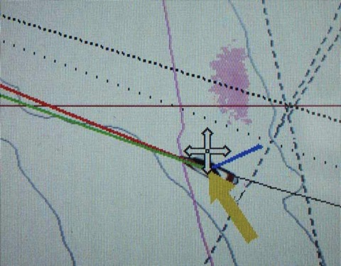
What a miracle that we can have this technology of Radar on our boats! Radar is a system that uses transmitted radio waves to determine the range and direction of objects. Radar (from RAdio Detection And Ranging) sprung from 1900's technology and came into effective use in World War II, where it was influential in the outcome of some major battles. German aircraft were detected approaching for the Battle of Britain in 1940, and at sea the first ships with Radar had a huge advantage against those without. Imagine opposing fleets on a dark mediterranean night, one with radar picking out the opposition, and the other essentially blind!
Today's modern radars benefit from dramatic improvements on this technology. Our current unit (an 18 inch Raymarine 418HD radome) uses a miserly 60 watts. A detailed image of reflected targets up to 48 miles away but using just the power of a 60 watt lightbulb! By concentrating that power into short bursts we can shine a 4000 watt pulse and catch the reflection as far away at 48 miles!
Reduced visibility and working in the dark is another big advantage of Radar. With flukey winds we have a slow passage from St Martin 80 nm across the Anegada Passage and our planned arrival in Virgin Gorda in the British Virgin Islands slips to 9 o'clock. We know the channel having done it several times, most recently just a few months earlier, otherwise we wouldn't attempt a night approach. But even with local knowledge and the weather clearing as we near Virgin Gorda it is very nice to have the radar on again, picking up small craft, and confirming the chart as you can see the island overlaid nicely in purple.
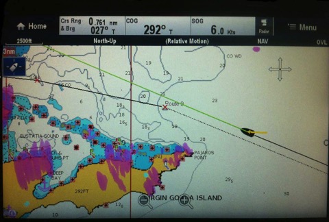
Note also the target showing as a purple dot on the top right of the screen above. The radar shows this boat is nearly a mile north of us, so we can keep an eye on him even though he is not properly lit and would otherwise be a bit of a worry. Another nice use of the radar!
Here are a few other uses for radar…
- Foggy conditions - extremely good in this situation it is a huge stress-reliever.
- Picking up buoys on approach in the dark or fog (set the radar to close range for this (our Raymarine radar has a "buoy mode" with tuning set for this)
- Confirming chart data for new areas we haven't visited - you can see the chart lines up with the "real world" as shown by the radar.
- Confirming AIS targets as the two will overlay revealing other non-AIS targets
Radar is an extremely powerful tool for the cruising sailor.
You Might also like the following...
Tropical Storm Chantal Arrives
Making Money While Cruising
Maintaining a Homebase
About the Southerly 49
Top 10 Canal Journeys
Sailing a Serious Ocean
Sailing a Serious Ocean is the same. John describes some of the most harrowing and exciting ocean conditions he has encountered, and with humility and clarity describes what he did right and wrong. As with all of John's books, his writing is evocative and he paints a picture of offshore passages. Winds blowing, waves crashing aboard, sails strained past the breaking point. But his stories are rich with technical details and perfect for those with less experience hoping to learn more. Each chapter also has additional sidebars that expands on details, such as "thoughts on waves" "weather information sources" "features of a bluewater yacht" and more. The combination of well-told stories and clear technical details makes a very readable format. The book that has got enough hard information presented alongside that you have gained real usable knowledge by the time you get to the end. And you have an excellent insight into the mindset of a fantastically experienced sailor. You might even find yourself signing up for a passage with John to learn offshore sailing yourself. Did I mention he offers offshore training? (www.yayablues.com)
Chapter Seven "Storm Strategies" - for this chapter alone the book is worth the price! But the whole book is a gem. Do yourself a favour and pick up a copy of "Sailing a Serious Ocean". After you have perused it and appreciated John's experience and storytelling, you can refer back to it as you plan your own passages on the Serious Ocean. I am tying in a third reef and going out to practice "Heaving-to" and "Forereaching".
You can pick up a copy from John’s website or from the Nautical Mind in Canada.
ARC Report - Backup Systems
Update 2014
Atlantic Rally for Cruisers (ARC 2014 edition) is getting underway tomorrow Sunday November 23) and I know everyone there will be scurrying around with last minute jobs, enjoying the last parties and getting ready for the start line tomorrow morning. It is a VERY exciting time and Sheryl & I wish all the participants Fair Winds and Smooth Seas. We did the ARC in 2012 and thought it would be worth republishing summary of how systems worked for the boat in our “quite windy” running of the Atlantic Rally for Cruisers.
ARC 2012
Before the start of the ARC in Las Palmas everyone was working on their boats and getting them ready - trying to prepare for all the conditions we would encounter in the 3000 mile crossing. Getting all the boats systems up and in top condition and preparing for all the contingencies. Trying to anticipate what could go wrong and how would we deal with the problems?
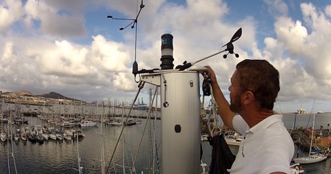
Here is a very un-scientific summary of how well systems, and backup systems, worked for boats on the ARC 2012.
Electrical Power systems
On this year’s ARC many boats reported problems with their electrical power. A number of boats had a malfunction with the main generator but were able to recharge the batteries from the engine. However most engine alternators produce less than you hope. The modern yacht does consume a lot of power. Similarly wind generators often do not work well when sailing downwind. And even the biggest solar array produces less than the typical modern boat uses on a passage. People with power problems had to turn off fridges, turn off autopilots (so crews were exhausting themselves hand-steering for thousands of miles !!!) and otherwise conserve power. The worst cases were boats that lost their engines and had no other way to generate power. In this case they finished the passage with no power left, in the dark!
What is your primary method of generating electrical power? Most of the larger ARC boats have a separate diesel generator, and many of the yachts less than 45 feet rely on the engine’s alternator to recharge the batteries. Some also have a reasonable capacity to generate electricity from Solar panels or Wind generators.
A number of people I spoke with did not know how much power they use. Many boats do not have a decent way to calculate how much they are adding/subtracting from their batteries. A quality power monitoring system is a must! Its essential to know how much power your boat uses on a passage. Refrigeration, autopilot, lighting, Nav instruments are all big users on passage and running 24-7 adds up! Some of the boats had left the cold northern European waters and were surprised how much more power the fridge consumed in a hot climate. Others just hadn’t done the math or worked out what they would need.
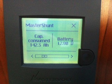
On Distant Shores II we are using almost 300 amp-hours per day on passage. This mean we need to run the generator 3 hours per day to put it back in. If the generator quit we would need to run the engine 4-5 hours a day for the equivalent power. We could also cut back by shutting down our freezer and/or fridge, turning off our plotter etc and would reduce power use by probably 50%.
If your backup power is solar panels, you may find it will not cover typical power requirements while on passage. But it is a great backup system with the main drawback being much lower production on the cloudy days we had, especially at the beginning of the crossing this year.
Whatever you do - consider your power requirements carefully, and plan a backup strategy to generate power in the event your main system goes down.
Steering systems
Self-steering systems and autopilots were another area where ARC boats had a number of issues. Heavy conditions in the first week broke quite a few wind-vane steering systems. Quite a few boats found themselves hand-steering when they had an electrical problem and had to save power. On Distant Shores II we have a Raymarine autopilot connected to a robust Lewmar drive unit. It steered flawlessly the whole way right up to the finish line! The boat, a Southerly 49, is quite easy to steer with her twin rudders and has a well balanced helm so the motor isn’t straining and doesn’t draw very much power.
Here is a video showing the Raymarine Autopilot steering in some pretty big seas.
Sailing Systems
Sails, masts, downwind poles and other sailing systems were perhaps the area where most ARC boats had done the most thorough preparation and had thought out what to do in the event of problems. Only one boat I know of lost their mast and had to divert to the Cape Verde Islands for repairs. Although we saw many broken boomvangs, torn sails, and other rig problems on the dock in St Lucia, everyone seemed to have had a strategy and was able to continue on without too much difficulty. For more info on rigs and rigging see my previous blog below...
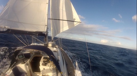
Water
Many ARC boats were relying on water-makers to provide water for the crew. Compared to the average cruising boat with 2-3 crew onboard for an ocean crossing, the ARC boats had 5 or more - and this means providing more water for the crossing. A 37-footer with 7 crew, and a 40-footer with 9 on board will need quite a lot of water.
On board Distant Shores II we carry 545 litres of water, and had just the three of us (me, Sheryl and friend, Matt Heron) on the passage. I have installed manual foot-pumps at the galley and in the aft-heads, which we use at sea, and turned off the pressure water system for the crossing. This helped us easily conserve water, and also meant that if a leak developed in the system we wouldn’t dump all our fresh water! In the event, it was great having the foot-pumps. We did save water without feeling constrained and arrived at the finish with more than a third of a tank remaining. We switched the pressure system on whenever we needed it (when having showers for example) but mainly left it off for the passage.
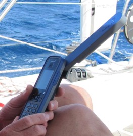
Propulsion
A number of boats had engine problems - the most major issue being a propellor drop off, to simply being unable to get the motor started. But everyone with this problem was able to sail right up to the finish line and then accept a tow into the marina.
Communications
Many boats had problems with various communications systems - but since everybody had backups of some form, no one was seriously inconvenienced. For example, our SatPhone stopped receiving EMail for 4 days, but we were still in touch with nearby boats over the radio and we could also make phone calls so reports could still be filed, and the Yellowbrick tracker kept on working fine.
Update 2014
Communications upgrades! Probably nothing has changed so much in the last two years since our ARC 2012 as communications. New Satellite phones, the Iridium Go, Inreach and other devices have all come online. If anyone has tested these out please chime in with your thoughts and experiences.
ARC Report - Rigs & Rigging
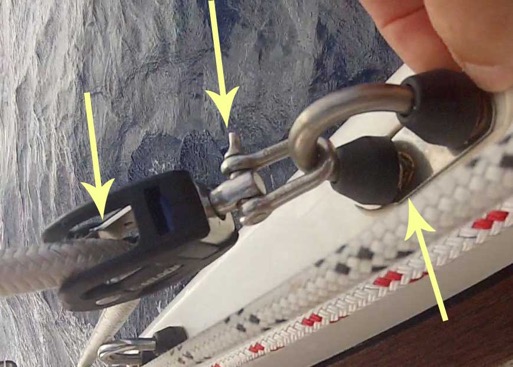
I installed this U-Bolt fitting in the rail (to the left) to allow us to run a preventer back to the cockpit. Good idea but not quite strong enough and not quite far enough forward to get a good angle.
We spent 14 days of the 15 day crossing sailing downwind and only jibed once. We were sailing with reefed main and the genny out on the pole when we got a gust of nearly 40 knots. A large wave smacked the stern around and this coincided with the gust so we rounded up and backed the jib. Trying to get back on course we overcorrected and that’s when we jibed! The preventer took a mighty strain and did actually prevent the boom swinging all the way across.
You can see the U-Bolt is bent, the shackle pin is banana shaped and the block shattered leaving only the stainless centre pin holding the line.
The problem was I hadn’t rigged the preventer far enough forward to get a good angle. We re-rigged it to the forward cleat and it was fine for the rest of the crossing.
Not everyone was so lucky. A number of boats suffered breakages due to jibing. Our neighbour very nearly lost their mast when they jibed and broke their upper spreader, upper shroud and boomvang. The rest of the crossing was done under double reefed main alone!
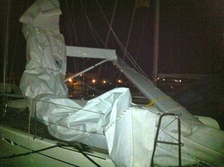
A number of boats broke their boomvangs, and/or broke their booms or boom-gooseneck fittings. Many had damage to their downwind pole. One boat was dismasted and diverted to the Cape Verde Islands. But looking at it another way... 230 boats started off on a journey of almost 3000 miles. That’s 690,000 sea miles to be travelled in total. With strong conditions for much of the crossing, it was a good test of equipment and preparation. Only a few boats retired back to the Canaries or to the Cape Verde Islands. The ARC recorded the fastest overall average time in recent memory, and most of the boats are now enjoying a Caribbean Christmas!
ARC Report - Communications
This time I will cover communications, from VHF and AIS, to HF Radio and Satellite, and email/internet on the ocean.
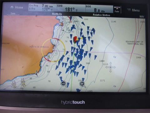
Regular followers of my blog will know I am a big fan of AIS, and highly recommend having an AIS transceiver. We have a Raymarine AIS650, which is a class-B AIS unit. This standard has been designed for pleasure boats and means that it broadcasts your position at a low power, usually visible to others from 5-8 miles away. We regularly saw ships over 25 miles away, and they always see us at least 5 miles off. Very comforting to know they are seeing us as they come towards us... the ARC requires boats to have an AIS receiver so we know all other ARC boats can see us. Somewhat puzzling is the ARC recommendation that boats fit an AIS class-A transceiver rather than the Class-B designed for yachts. At any rate, I would estimate more than half the ARC boats have just a receiver - meaning we will not see them at sea. So this picture of our AIS screen as we left Las Palmas is less than half the fleet!!!
VHF
Of course everyone has a VHF radio these days, and on the ARC it is much more use than normal since we saw so many other boats on this crossing. Out in the open ocean I think we have not seen more than a handful of boats in all our miles at sea. On the ARC we saw boats almost every day! And it was nice to call them up for a chat! I highly recommend a handheld VHF as a backup in case of a problem with the main set.
HF Radio
The ARC regularly organizes SSB nets for the crossing. We have always made use of HF radio nets and the ARC nets were very fun. Even in the satellite age, for long-distance cruising the HF marine radio is still a great tool.
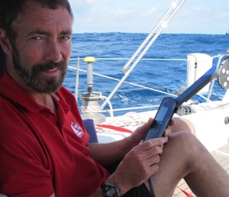
We bought an ISatphone-Pro and it was our first experience with a sat-phone. As a phone it is actually pretty good and we made a couple of phone calls from mid-ocean. The signal was good and did not have an appreciable delay. However we had planned to do SMS messages and also use the phone for internet access and in this case the experience it was not so positive.
I should preface this with the warning... I am still grumpy about all the trouble I had with the satphone on this trip. But realistically it was a good phone! Just not so good for data and SMS.
Perhaps you remember back about 20 years when you had a 9600 baud modem to get on the internet? Well, satellite phones are lucky to get speeds like that! The Iridium phone can offer data at speeds up to 9600 and our ISatphone reaches just 1/4 of that at the lofty speed of 2400 baud. There is no way to get on the internet for regular web access. The only possibility is email access. We understood that and had tested it out in Las Palmas before we got under way. it worked alright and would take 3-4 minutes of access to retrieve a few short emais plus our GRIB file.
One complaint I have is that the actual speed we got is not up to the promised 2400 baud. Connect time and signal dropouts on the voyage meant that we took many minutes just to connect and retrieve a few small emails.
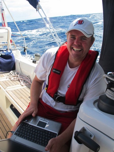
SMS
The ISatphone can also do SMS messaging and we planned to do regular twitter updates using this feature. It is not exactly user friendly for text. Remember back before smart-phones when you typed texts through the number pad? That is how the SMS feature worked. Not so bad but our particular phone had a bug that caused it to mysteriously reboot while I was typing texts. Sigh... I hope this was just a random defect in our phone.... I will investigate further.
Yellowbrick
This is a nifty satellite tracker device that the ARC fits to every participating boat. It looks like a handheld VHF and was just Velcro-ed to the stern rail. This unit transmitted our position every 4 hours. The ARC website has an excellent tracker program which allowed family, friends and everyone to view the race! Yellowbrick also make these units for purchase (ours were special ARC race units) that apparently also allow you to use it to send texts from your phone. We haven’t tested this kind of unit but it seems interesting.
SSB Radio with Pactor Modem for Email
This is the other main email service people used on the ARC. We haven’t tried this but all the people who have one have been satisfied. Basically you get a Pactor Modem (~$1200) to connect to your SSB radio (such as the Icom M802). Speeds are comparable to Satellite at perhaps 4800bps. No web surfing but the big advantage is you aren’t paying for satellite time! The $250 annual fee for Sailmail HF service is much less than anything you might pay for a satellite service.
Safety Inspection - ARC
Why have a safety Inspection
For many years all offshore races have had safety requirements to insure boats meet a minimum requirement for seaworthiness and safety. For an offshore rally it is the same, and the ARC has borrowed from the Ocean Racing community to make up their requirements. Many of the boats taking part have never crossed an ocean before, and even if they have, an inspection reminds us to focus on the important things and get the boat safe for sea.
What are the safety requirements
The ARC information pack (check here for info) includes specific details for required safety equipment so most people have got a handle on the items they will need to upgrade before they reach Las Palmas. Most of the items will already be installed on the average cruising boat. A VHF with external speaker, a bilge pump operable from on deck, a SOLAS approved EPIRB, jacklines to clip on while going forward etc.
However, a number of items regularly give people trouble. For instance, we use a powerful rechargeable handheld spotlight, but the ARC requires the spotlight to be plugged into ships power. There was a huge pile of these spotlights in the chandlery last week, mostly gone now, indicating it is a common problem. So I have just finished installing and wiring up a 12Volt outlet by the helm.
The ARC also requires a very specific liferaft standard - which is another major consideration as it is quite a pricey piece of equipment. The raft must be either an ISO9650-1 standard, or SOLAS or ISAF (Racing). Most commonly found is the ISO-9650 standard. However, our liferaft (just 2.5 years old) is not an ISO certified raft and therefore failed the test. We have had to purchase a new one - 1800Euro - OUCH!! The new one comes today...
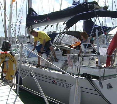
Inspection Day
Our inspector, Rob, arrived with a cheerful smile and described the procedure for the inspection, normally taking less than an hour. Normally he chats with the skipper to determine the experience and sailing history, and to try to put people at ease - it does feel slightly like a test... Next we follow him around the deck as he notes our nice tight lifelines with lashings so they can be cut away to get a man out of the water easily. He tugs on our jacklines and glances at the rigging as we head forward. In 15 minutes we have been around the deck and are back in the cockpit to inspect the emergency steering system. I point out that our Southerly has 2 duplicate steering systems, each with a wheel driving a rudder, and a beefy link arm between them. However, Northshore also fitted a backup for the backup with an additional spare tiller arm. Although we don’t need this for the ARC inspection I get it out and fit it anyway since I have never actually tried it before. It seems to work fine although I wouldn’t want to steer far with it ;-)
We demonstrate the external/manual bilge pump, check clipping on points in the cockpit and admire my new 12V outlet for the spotlight.
Heading down below we look at tie-downs for heavy equipment to make sure items like the batteries are well secured. We notice our stove clip needs adjusting as it is not correctly clipped. If the boat went over past 90 degrees the forward gimbal would fall out. Quickly corrected... We also pull out our bolt cutters for clearing away rigging.
In the bilge we check there are bungs ready to go by the thru-hulls. We get out our grab back, and check over our flares. Most boats will need to add a few flares to qualify for the ARC. They have a requirement for 4 white handheld flares as well as 6 SOLAS parachutes and 4 red handheld. I don’t know anyone who uses the white flares. The idea is to add light to a rescue scene. Personally I would never fire a flare just to add light - too much chance of an injury caused by the flare itself. Like everyone else we lined up in the fabulous local chandlery "Rolnautic" and added the required flares. As they work with the ARC directors, they know in advance which are the tricky items everyone will need. They have boxes of white flares!
Lifejackets are another interesting one. If you are a US flagged vessel you can get a way with USCG Type-1 jackets. Everyone else will need jackets with a crotch-strap and also a face mask. These are also available in Rolnautic nearby. We purchased these attractive facemasks to add to our existing inflatable jackets along with the light and whistle we already had stuffed inside them....

The rest of the inspection was relatively straight-forward, but we still had a middling list of small items for the chandlery.
Check out the following video from the ARC.
Stormy Seas Autopilot Steering Video
Stormy Sailing Sneak Peek
Check out this EXTENDED video feature of the ARC Safety Check.
For the Whole Atlantic Rally Experience and much more check out our whole Season 9 set of programs - on DVD or Vimeo
Plan your passages around the world with us aboard Distant Shores

Order the Super Pack on DVD and get Season 1-10 Downloadable.
Order the Super Pack on Vimeo and we will send you the code for Season 10 as a bonus.
ARC Atlantic Rally for Cruisers - Stats
Sheryl and I have decided to take part in, and to document, the Atlantic Rally for Cruisers - popularly known as the ARC this year. Naturally we have been preparing for the transatlantic crossing for some time now , but now we are also getting to see what its like to get ready for the ARC. We have downloaded an ARC manual/handbook which is actually quite a big booklet with information on safety, boat equipment requirements, port information, sailing tips and MUCH more.
Some ARC statistics of interest concerning the average boat that is entering the ARC this year..
15.1Meters long - that’s 49.7 feet
- biggest boat is the 28 meter superfast "Bristolian" ex "Mari Cha II" - its for sale too!!
- smallest boat is 32 feet - 9.7 meters
- 28 boats are brand new!! - launched in 2012
- The oldest boat is 76 years old!
- less than 10% of the boats are cats - just 21 of 230
- we have 3 crew as our friend Matt is joining us from Dubai
- if you fancy joining the ARC, some yachts take paying crew ...
So Distant Shores II is just about average - we are a 49 foot monohull (a few inches shorter) and a few years newer but with just 3 crew instead of 5.
If you are interested, here is a list of all the boats in the ARC this year
and a tracker to see how everyone is doing
.
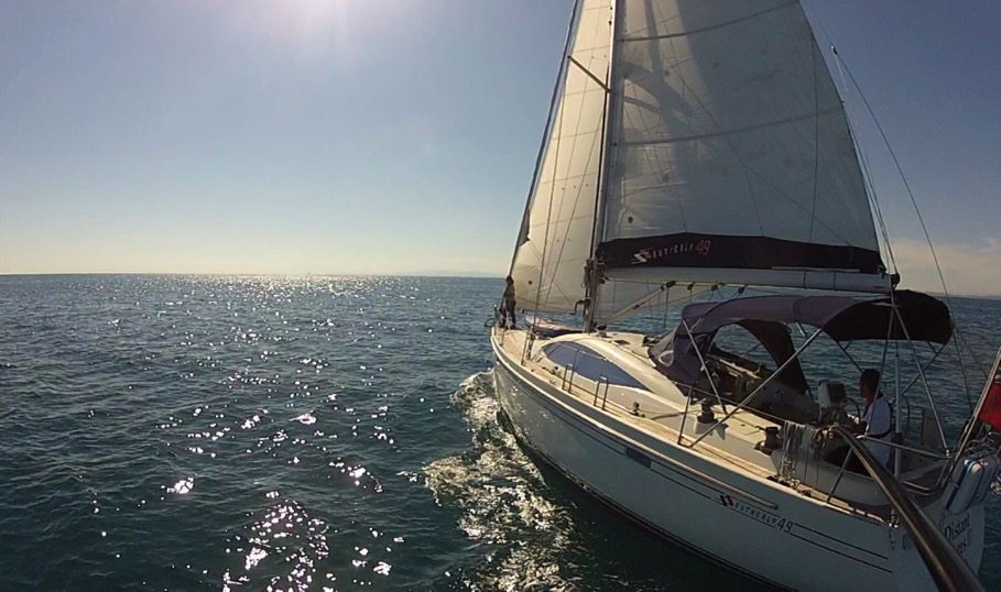
We are looking forward to getting in to Las Palmas next week to see what the preparation is all about!
Anyone out there been thinking of doing the ARC??
Downwind Sailing - Preparation
The Downwind Rig
Prevailing winds on the standard transatlantic route will be almost dead astern. Sailing with the wind this far aft means we need to pole out a headsail. While bigger crews might try to fly a spinnaker, we use a jib or genoa. Some boats even have two poles allowing them to put out two headsails. The twizzle rig is another alternative... google it ;-)
Here is our basic setup - main well out (with a preventer) and genoa poled out opposite.
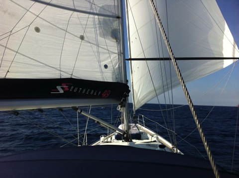
Pole Setup
In this picture you can see our pole downhaul running up to the pole end from near the shrouds. This has worked well enough for occasional use but it is better to have a foreguy. This will be a line running from the foredeck back to the pole end. That’s a project I am working on now, putting a block on the foredeck and running the rigging for it back to the cockpit. I figure $200-300 for this. We already have a nice pole topping lift and a very nice system controlling the pole inboard end on its track.
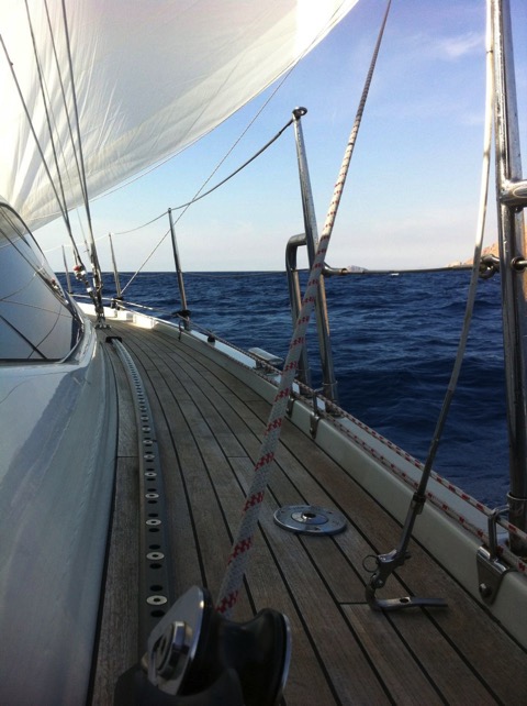
Genoa sheet
In our case we have an inboard genoa track, so the sheet rubs on the lifeline when it is poled out. This won’t be good for a long crossing so I set it up running out the gate. This isn’t a very good long term solution so I plan to run the sheet aft t a block on the aft corner. This will reduce stress and friction as well.
Balance the helm
For many long downwind miles, the autopilot will be steering and we want to be sure we have the boat as well balanced as possible for easy steering (actually we would want this also if we were hand steering). Today wasn’t a bad day to test since tide against the swell was producing a bit of a roll. The transatlantic will be rolly since you are generally running in 15-20 knots with seas astern. In our experience these can be 2-3 meters. I find our very deep keel steadies the roll quite a bit. We draw over 10 feet with the keel down and that does seem to help. Also the twin rudders seem to make her track very well downwind. For our previous boat Two-Step (which was a full keeler info here) it was tougher to balance downwind. I found we had to reduce the mainsail to double reef so she didn’t slew around. This effectively moved the centre of effort forward so she didn’t want to round up.
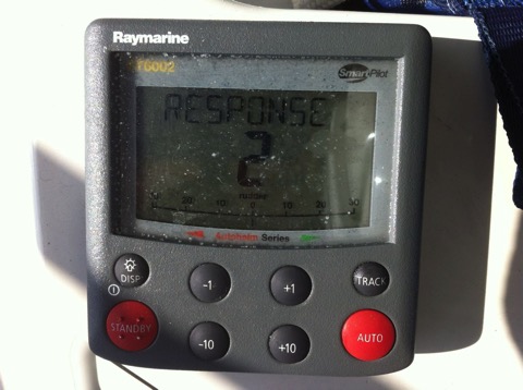
Autopilot Setting
Reduce the autopilot settings to match the seas and use minimum power. We have a Raymarine Autopilot system tat has a "response" setting. By default this is set at 5 every time you turn on the breaker. I generally reduce that number (making it less sensitive) and have been using a setting of 3. For rougher water the boat will naturally weave bit around her set course, so a higher setting just means the autopiot is doing more work correcting when the boat would come back anyway. I have been trying settings of 1 and 2 and they seem to work very well. You might try adjusting the settings on your autopilot to see what you can get.
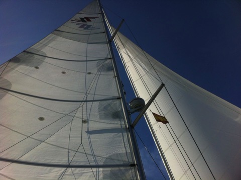
Chafe
With our swept spreader rig we will need to watch chafe on the spreader ends. I will be adding chafe patches to the sail where it rubs on the spreaders. I will do this for the 1st and second reefs since we are likely to use these on the breezier days. Discs of the adhesive sailcl;oth about 20 cm in diameter work well and are easy to apply.
I also take a very close look at reefing lines, sheets and blocks etc to check for any small chafe. Over a long passage this can add up quickly to a bigger problem. This one passage will be more downwind miles than we have done so far in the 8000 miles we have sailed Distant Shores II.
Enjoy!
The tradewind passage across to the Caribbean should be an enjoyable crossing. It will take between 2-3 weeks so time spent preparing for it is well worth it. And will help make it fun!
Force 8 Sailing
Sailing in a Gale
We were tied up in a secure harbour on the Sunday morning. The wind was already blowing in gusts over 30 knots and it looked like nobody was going to go out sailing. The weather service on the VHF was forecasting a gale warning. But I saw an opportunity to give the new boat a decent test in strong winds! Looking at the chart I saw a harbour just 25 miles down the coast which would mean we could sail with an offshore wind on the beam. So we wouldn’t be in big seas and would have a chance to try out the boat in strong winds for just a few hours. Perfect...
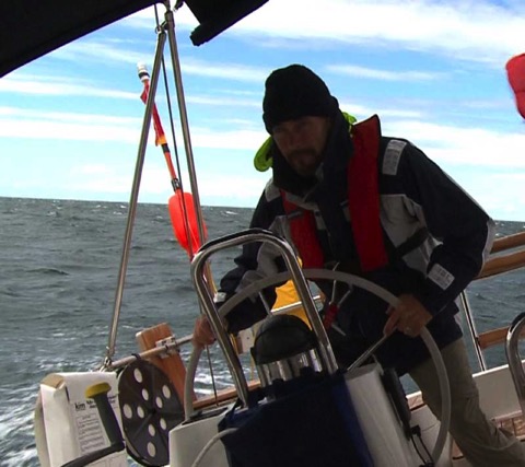
We battened everything down, untied, and headed out from the tiny harbor of Gislövs Läge. I had planned to sail with a double reefed main and reefed job, but there seemed to be more wind than forecast so we just partially unfurled the jib (no mainsail). The wind gusted over 30 and we scooted along at more than 8 knots - hitting 9. As soon as we got further out the wind stabilized a bit at 25-30 with gusts 35-40. But I had been right that we would have a nice comfortable ride since the wind was offshore - we never saw waves bigger than 1 meter.
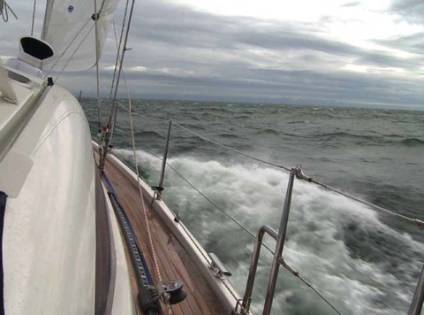
The image doesn’t show it so well but you can see the bow wave being blown off in spray in the gusts. But also you can see the waves weren’t high.
We averaged over 8.2 for the 3 hours it took to reach Ystad. The boat was perfectly balanced and easy to steer. Dry decks and a comfy ride! The longer boat at 49 feet really does make for more comfort. During the whole sail we saw one other boat - a 40 footer close-hauled and motor-sailing west (the other way). Incredibly he was towing his dinghy - which naturally had flipped upside down. He must have been having a bad time since he just ignored it and kept on going with it upside down.
The only other boat we saw was just as we approached Ystad - the local Search and Rescue cutter came out and zoomed past in a cloud of spray. Winds gusted here at 40 knots - occasionally higher. We sailed right up to the harbour at Ystad and came in to find a dock. Thankfully the winds were lower close in shore since the harbour was quite full. But friendly cruisers grabbed lines as we came in to raft up. Praise to our big fenders and bow thruster so maneuvering in these tight conditions was no problem.
As a postscript to this story I found a news item the next day that 4 sailors had been rescued by Polish SAR in that same gale just over a hundred miles to the southeast.
We had a great sail however. It felt good to have tried the boat out in these conditions when it would have been easy to just stay put. Now we have more experience with how our new boat handles in strong winds so if we’re ever caught out in bad weather on a passage we now know that she handles winds up to 35-40 knots quite nicely with just a reefed jib. We filmed this in Episode 86 Distant Shores downloadable here in Vimeo - click on Episode 86
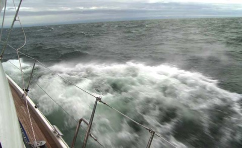
For more on stormy sailing check out our other blogs on Storms
Plan your passages around the world with us aboard Distant Shores

Order the Super Pack on DVD and get Season 1-10 Downloadable.
Order the Super Pack on Vimeo and we will send you the code for Season 10 as a bonus.
Dealing with Shipping
AIS to the rescue! This crossing was another good example of why an AIS unit is an excellent investment for anyone venturing out into busy waters. We left the dock in Chichester at 0100 and by 0130 had cleared the mouth of the harbour into the English Channel. Our plotter on deck showed our position as well as the fact that we had more-or-less got the expected current. It also showed all the ships in a good 20 mile radius since the AIS receiver passes that info on to the Raymarine plotters.
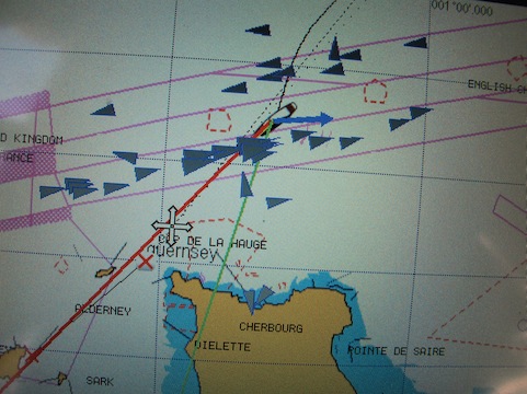
We shot this image a bit later as we were closer to France. The blue arrow on our boat indicates the current, the red line our heading and the green line where we are actually going with the effect of the current. You can see there are quite a few ships just ahead as we approach the east-bound shipping. When we zoom in we see most of the ships will pass easily ahead or behind us since the AIS also calculates the “closest point of approach” and the time until that point for each ship. Best of all we know the names of the ships so we can call them if we think there is a problem! In this case none were close enough to warrant a call. The stress reduction from having a plotter on deck with AIS info on it is truly amazing!
Now for the first time we have an AIS transponder meaning we are also transmitting so the ships can also see us on their display. Even better!
We arrived in Guernsey in the early afternoon after a calm and stress free crossing. Then on to Jersey where we saw the highest tides we have ever seen!! We arrived just after low water and waited outside the marina.
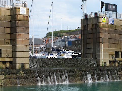
We are looking at the only entrance to the marina. This wall is the “sill” and is almost 3 meters high blocking our way in. When the tide rises it will cover the sill and allow us in. It will actually cover the sill by more than 5 meters! The tide this day was 10 meters - over 30 feet!!
I took this from the quayside - basically what will be water level when the tide is up. It is quite amazing sailing in these waters since the whole landscape changes so much with the dramatic rise and fall of the tides.
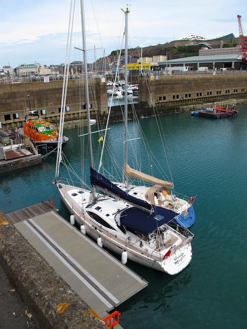
Sailing a Bigger Boat
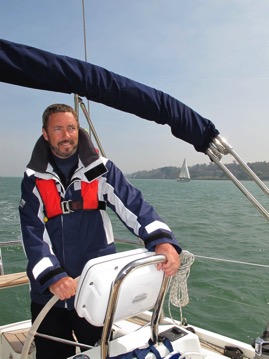 We have had a few weeks of test sailing now. The spring here in south England has been lovely and we have been able to get out on a number of excursions. Although we are still getting the feel of the new boat - we have a number of observations on how she handles. It has been great to have this time with her without making any big passages!
The Bigger Boat
She is bigger inside and has more storage but doesn’t feel that much bigger to handle. I was wondering if the extra size would make it more difficult to maneuver especially in port and in close quarters. But in fact she feels quite similar to the Southerly 42. Although she is 7 feet longer she is just 6 inches wider and the same height. So she feels quite like the 42. Spinning her around in a marina requires me to take the extra length into account but we have had no problems. She handles very well in reverse, and add the excellent bow thruster and we have been fine. We have now wiggled our way into a number of tight slips. (We do have some nice big fenders and thats a good thing with any boat I think)
- practice makes perfect (or at least better)
- try out a new boat away from the dock
- get the feel of her in cross winds, how fast she turns, stops starts, which way the prop kicks etc
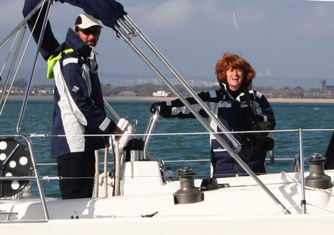
Sheryl having way too much fun!! (Photo by Yvette Jordan, SY M’LADY)
Bigger Stronger Faster
Of course one of the big advantages of a longer boat is a longer waterline which (on similar boats) should equal higher speeds. We have found this to be the case. The 49 can make 8 knots under power and so far hit 9 under sail. I know she can do more!
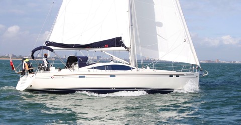
Distant Shores II sailing in the Solent (Photo by Yvette Jordan, SY M’LADY)
Comfortable Motion
The longer waterline also means less pitching and a smoother motion. We have not yet been in big seas with her but at least in moderate seas she shows the waterline length plus extremely deep keel makes for a very steady ride. (she draws 10 feet!!) Motoring out the Chichester Harbour entrance with swell against the out-flowing tide she cruised right through. Next to us were a contessa 26 and another 30 footer. The two smaller waterline boats were pitching quite a lot - showing their keel and burying their bows. A 42 footer was coming along as well and they were more similar to us - cutting through with minimal pitching. Waterline pays big dividends in comfort!
Sailing Like a Dinghy!
The day that really put my mind at ease about the bigger boat... we took out two local friends who are top-class dinghy sailors. Elizabeth and Mimie have sailed in Chichester Harbour all their lives and know every inch of the place. (They have plenty of experience cruising around the world in keel boats as well). It was a breezy day and we had the self-tacker and one reef in the main. I let them take the boat as I filmed. You can see the grins as they steered Distant Shores II around the harbour!
You can also see how close we are to the other boats. Their verdict was she handles great!! And to top off a perfect day we took her up to the head of the creek at high tide and then at low tide she was beached right in front of the pub!! The Crown and Anchor for dinner!
We sailed most of the way up to here at high tide.
With the tide gone there is just a shallow creek left.
Heres the view from our table in the Crown and Anchor
Plan your passages around the world with us aboard Distant Shores

Order the Super Pack on DVD and get Season 1-10 Downloadable.
Upwind to the Caribbean
There are two main strategies for a North American boat wanting to get to the Caribbean...
1) The Thorny Path - jumping from island to island through the Bahamas, Turks & Caicos, Dominican Republic and Puerto Rico. (yellow arrows)
2) Offshore - directly offshore from Beaufort or North of there to the BVI. (red arrow directly fro Beaufort North Carolina)
Our plan was to modify the second option and jump off from the Bahamas heading directly east to join the offshore route, then head SE to the Caribbean. This would be a passage of over 1000 miles and the prevaiing winds are from the east so this initial easterly push would be dead into 15-20 knots. My plan was to wait for a cold front, and use the wind shift to hitch a ride and hopefully gain some easting that way.
With option 1) The Thorny Path, one might spend 2 months getting south. Our option 2) would take 2 weeks (one waiting for a front then 7-8 days sailing direct tp the Caribbean.
Of course any boat planning this must be completely prepared for some tough going. The front means you might be out in 30-40 knots of wind as the front passes, and the rest will be close hauled in 15-20 or higher.
Distant Shores is a very good boat for this passage since she is quite good close hauled. We swung the keel all the way down to our full draft of 9-feet, and with our long waterline we go upwind very well.
It was also important to be able to go fast enough that we would be able to stay with the front. The idea that as the front approaches the winds will clock around from the proveailing Easterly, to South East, then south. Then they will build in strength and clock further to the South West. As the front arrives the wind will switch to the North West then north before settling back to North East. We planned to use the period where there was no East in the wind to make our way east. The wind would be aft of the beam for all that time. The two problems are ...
1) fronts can be quite strong and pack winds of 30-40 or higher was they pass
prepare your boat for winds up to 50 knots, we used or triple-reefed main and reefed our small tough jib
2) a fast moving front might run past so quickly that we wouldn't get far enough east.
we averaged 170 miles per day and kept up with the front using it to make almost 500 miles easting
Summary:
Offshore route is a possible option if your boat and crew are prepared for a tough week at sea.
Be prepared for strong winds and tough uphill condiions.
Watch the weather in advance to see how the fronts are passing.
Plan your passages around the world with us aboard Distant Shores

Order the Super Pack on DVD and get Season 1-10 Downloadable.
Order the Super Pack on Vimeo and we will send you the code for Season 10 as a bonus.
Transatlantic Musings
What a winter its been! From a very late season crossing of the Bay of Biscay, a lovely Transatlantic with Wayne & Angie making up a crew of four, and then island hopping from Antigua, Barbuda, Anguilla and St Martin. Now we are relaxing in the BVI and having fun with our "share the sail" guests. In a few weeks we will set sail north from the Virgins and head for the Turks and Caicos and Bahamas. There is still time to book one of these legs and they promise to be exciting - a few days at sea and a few days in remote tropical paradise.
Transatlantic Notes
Here are a few musings from the passage.
- fast ! we were on track to cross in 16 days until the final 500 miles when we had very light winds and calms even. Just when we expected the trade winds to be at their most predictable an unusual low pressure north of us took all the wind away. So we got to practice our very light wind sailing. The problem was 2-3 meter waves from the sides kept us rolling too much so sail effectively. So our final passage time was 18 days. Still very respectable.
- daily runs - we had a few daily runs over 170 miles.
- dealing with chafe - always a problem on long passages since the sails can be set in the same position for days at a time. We had problems with the batten pockets on the main sail chafing on the shrouds on our passage to the Canary Islands so we applied some chafe patches before the transatlantic. Still more work is needed on this since the patches we applied chafed through quite quickly on the passage! The problem is the battens make a hard point and the swept back spreaders mean they touch the sail even on a beam reach. Since we were sailing on a broad reach we had to live with the sail touching the spreaders and shrouds. My next plan is to try leather patches on the batten pockets.


Join our email list and get hints, technical articles and tips plus videos to help you achieve your cruising dreams.
- FREE 1/2 hour video on cruising the Exuma Islands in the Bahamas
- Technical Blog shows you how to deal with issues facing the cruising sailor
- Destination information from some of the world's best cruising areas
- Special discounts and promotions
